What is a geographic information system?
Introduction
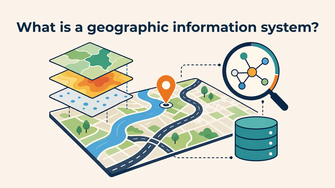
A geographic information system (GIS) is a system designed to collect, store, analyze, and visualize data on a map about objects or phenomena that have a geographic location. Its primary distinction from other information systems is that it links data to a specific location: where a well is located, what area a road crosses, or how densely a district is populated.
In a standard spreadsheet, a well record might read: "Well 12, depth 45 m, coordinates 40.96° N, 70.77° E". The table merely stores this information. A GIS displays the well on a map, compares its attributes with neighboring wells, and analyzes features within a set distance from it. Answering the question "where?" based on data is what distinguishes GIS from a regular database.
What does GIS consist of?
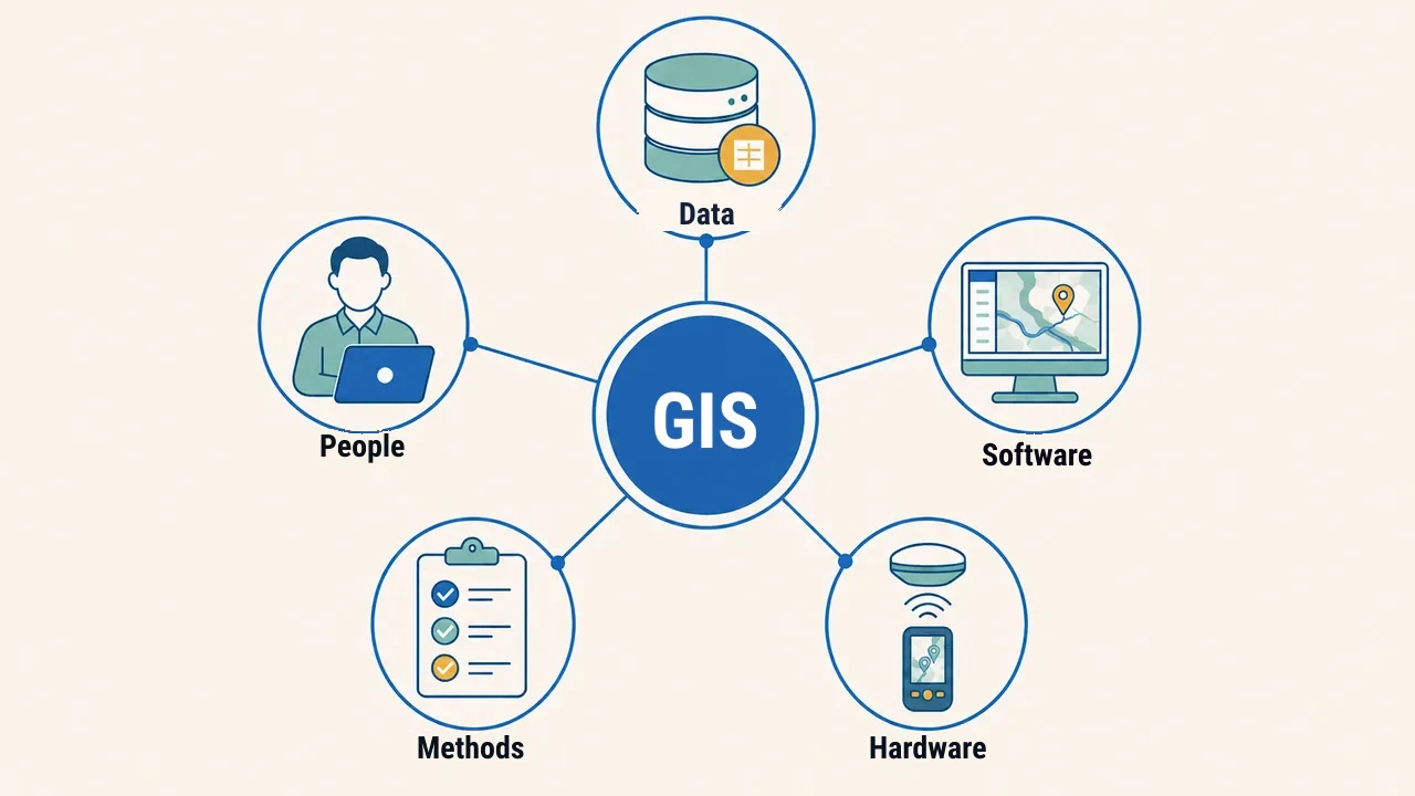
A GIS can be understood through several core components:
- Data — the foundation of the system: information describing geographic features or phenomena.
- Software — tools like QGIS and ArcGIS Pro that display and analyze data.
- Hardware — computers, servers, GNSS receivers (such as GPS), and other equipment.
- Methods — procedures and standards for collecting, validating, and analyzing data.
- People — specialists who bring all components together and make data-driven decisions.
Many view GIS merely as software, but without quality data and sound methodology, no software produces reliable results.
Spatial and attribute data
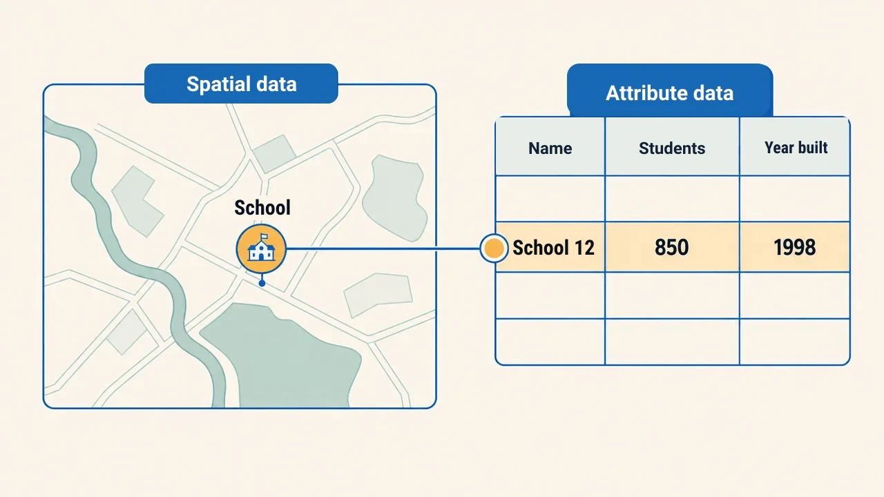
In the vector model, a feature is typically represented by two connected parts. The first is spatial data: feature geometry and location (point, line, or polygon). The second is attribute data: descriptive characteristics stored in tabular form.
For example, a school is marked as a point (spatial part), and an attached table lists its name, student count, and year built (attribute part). This connection enables queries such as "show schools with over 500 students on the map."
This link defines the power of GIS. The spatial component answers "where?", while the attribute component answers "what and how?". Working together in one system, the map becomes an interactive, queryable data source rather than a static image.
How does GIS differ from an electronic map?
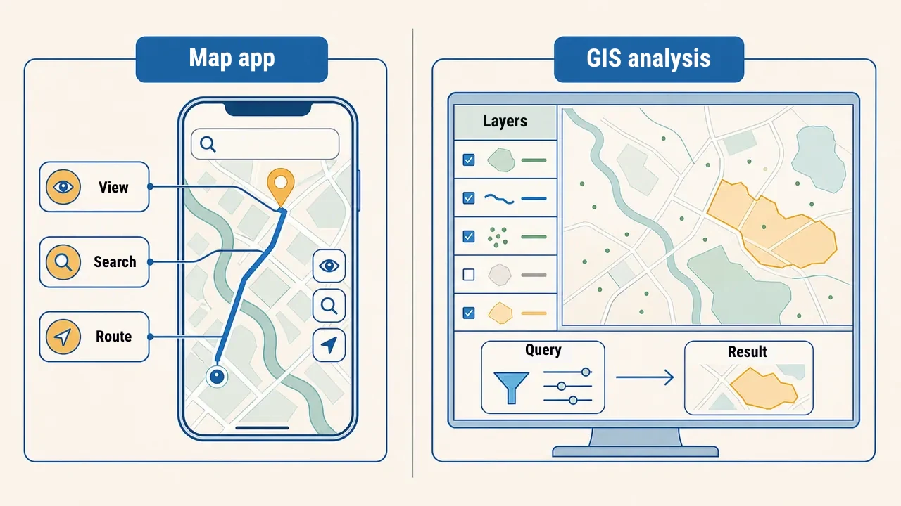
Many equate GIS with phone map apps. Both use spatial data, but in a mobile map app users primarily view maps, search locations, and find routes. In a GIS workflow, specialists manage data models, layers, queries, and spatial analysis parameters. For instance, GIS makes it possible to:
- identify all buildings within 500 meters of a river;
- overlay two layers to find their intersection;
- compare population density with hospital locations to show underserved areas.
Analytical reliability depends on input data quality. Before starting work, the coordinate reference system (CRS) and update date in metadata are verified for each layer, geometry errors identified, and attribute completeness evaluated. For example, in a 500-meter distance analysis, specialists confirm whether the tool uses geodesic calculations or the layer is in a suitable regional metric projection. Otherwise, a convincing map result may be practically wrong.
Such analysis creates new information rather than simply showing an existing map. Thus, GIS is a decision-support tool, not just a viewer. While a map app answers "how do I get there?", GIS helps evaluate prospective sites for a new school based on data.
Where is GIS used?
GIS is a cross-disciplinary tool applied across many fields today:
- urban planning — land parcels, utility networks, building permits;
- agriculture — crop monitoring, irrigation networks;
- environment — monitoring forests, water bodies, and pollution sources;
- emergency management — assessing flood, landslide, and fire risk zones;
- logistics — optimizing delivery routes.
In land cadastre and surveying, GIS is also used to manage layers, verify field measurements, and merge territorial datasets.
Conclusion
A GIS unites geographically referenced data in a single system to generate new results and insights. It consists of data, software, hardware, methods, and people. When spatial and attribute data operate together, GIS supports analysis and decision-making unlike a simple map. Entering geospatial science begins with understanding how to answer "where, and why right there?" based on data.