Aerial photography and drone imagery
Introduction
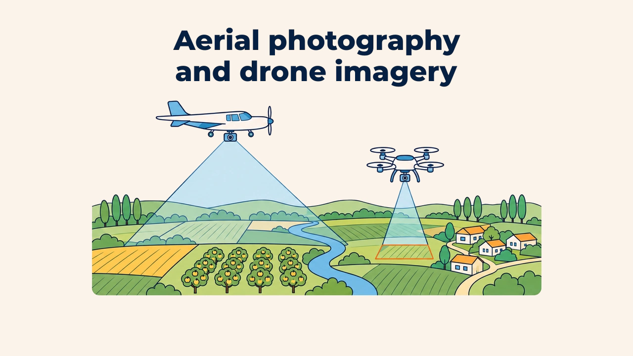
An aerial photograph is an image of the Earth's surface captured from an airborne platform within the atmosphere: aircraft, helicopters, or drones. The fundamental distinction from satellite remote sensing is proximity: the sensor operates hundreds of meters to several kilometers above ground rather than hundreds of kilometers in space.
This close vantage point provides centimeter-scale detail, giving project managers complete flexibility over collection schedules. In return, ground coverage per flight is small, requiring more operational effort from flight planning to photogrammetric processing.
Aircraft and drones
Traditional aerial photography utilizes large-format cameras mounted inside aircraft. A crew can map an entire city or district in a single day, which is how topographic maps were updated for decades.
Unmanned Aerial Vehicles (UAVs), commonly known as drones, have emerged as an affordable alternative for smaller sites. Multi-rotor drones hover in place and launch from tight spaces, while fixed-wing drones cover broader territory in a single flight. Drones can carry standard RGB cameras, multispectral sensors, thermal imagers, or lightweight LiDAR units.
Flight planning and image overlap
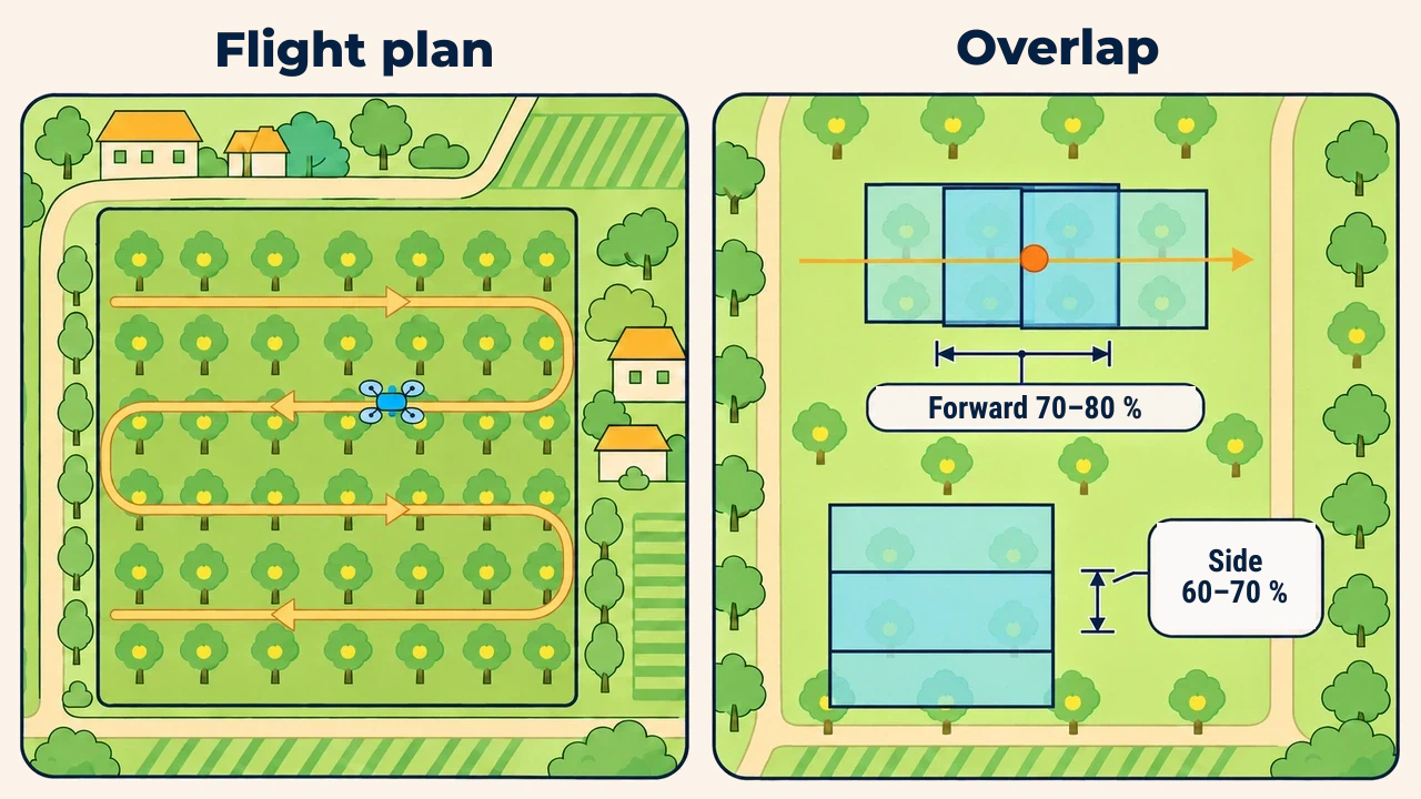
Drones survey areas along parallel flight lines, capturing photographs every few seconds. Photos must overlap systematically: overlap is typically set to 70–80% along the flight line and 60–70% between adjacent flight paths. Photogrammetric reconstruction requires each ground point to appear in multiple photos from different angles.
Image detail is measured as Ground Sampling Distance (GSD)—the ground distance represented by a single camera pixel. GSD is directly proportional to flight altitude: doubling altitude doubles GSD (coarsening resolution), but expands coverage per flight. The broader implications of pixel size are explored in types of image resolution.
From raw photos to an orthophoto
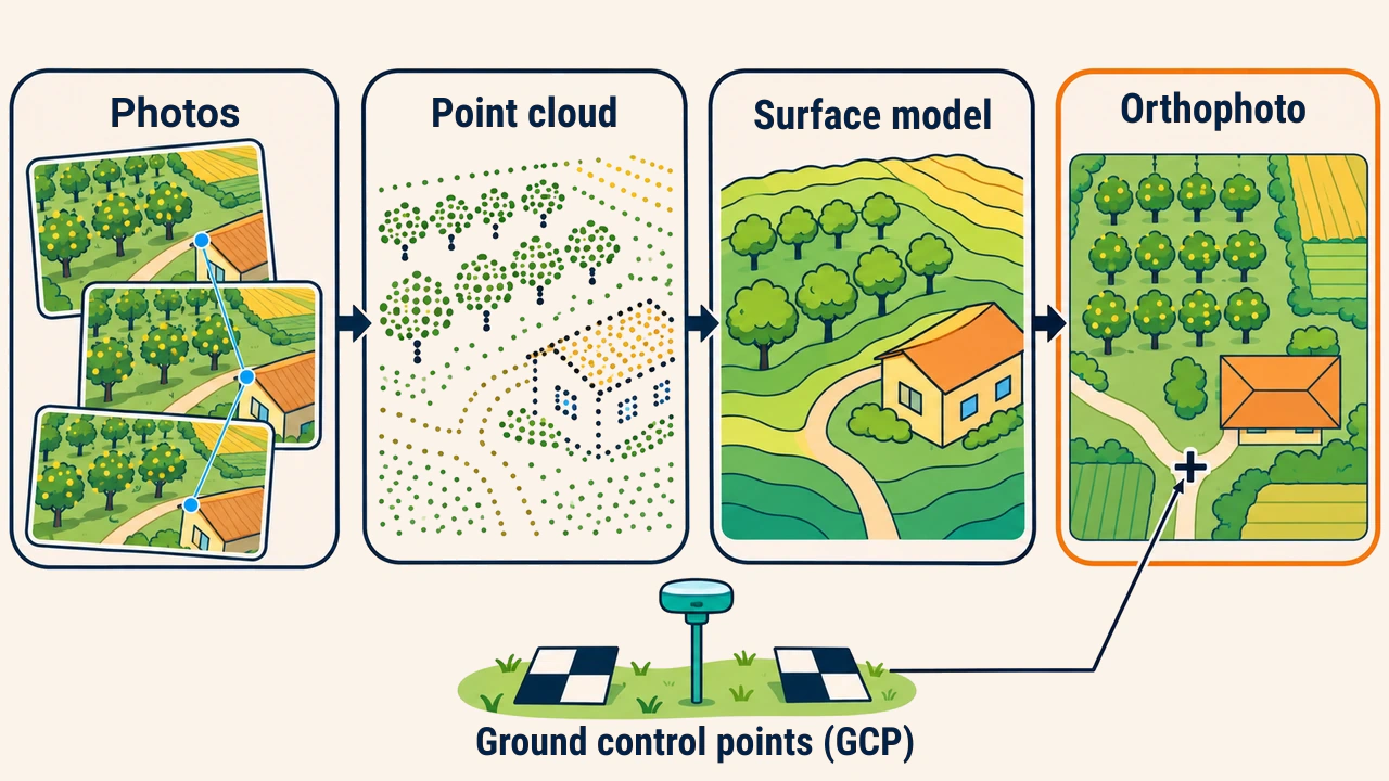
Hundreds of aerial photos do not constitute a map: each is captured in perspective projection, causing buildings and trees near image edges to lean outward. Assembling them requires digital photogrammetry. Specialized software identifies mutual tie points across photos, calculates camera positions and orientations, builds a dense point cloud, and interpolates a surface model.
This surface model corrects relief displacement and sensor tilt, generating an orthophoto. An orthophoto exhibits uniform scale, allowing analysts to measure distances and calculate acreage just like on a topographic map.
Absolute positional accuracy is ensured by Ground Control Points (GCPs): physical targets placed across the survey area whose coordinates are measured using GNSS receivers. Without ground control, consumer drone mosaics drift by several meters; utilizing surveyed targets or onboard RTK corrections reduces spatial errors to centimeters.
Drone versus satellite imagery
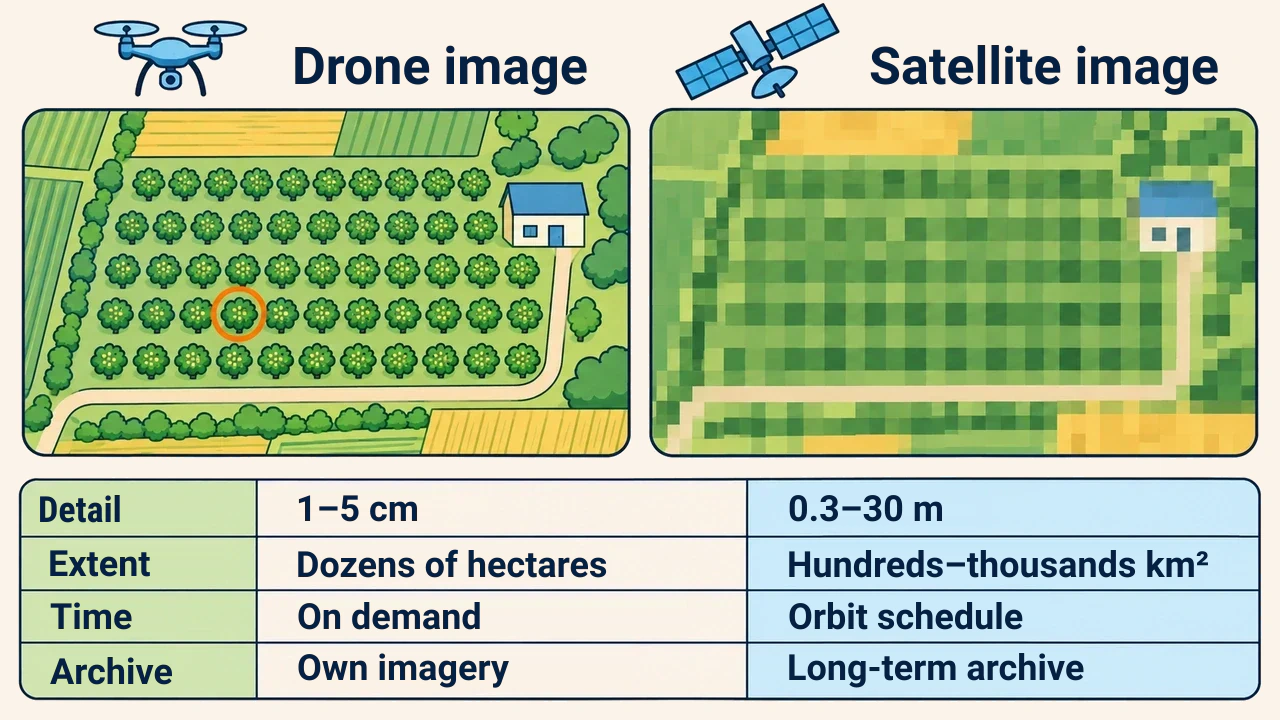
| Criterion | Drone imagery (UAV) | Satellite imagery |
|---|---|---|
| GSD | 1–5 cm | 0.3–30 m |
| Coverage (flight / scene) | Tens of hectares | Hundreds to thousands of km² |
| Capture timing | Selected by project team | Dictated by orbital schedule |
| Cloud sensitivity | Flown below cloud bases | Optical scenes blocked by clouds |
| Historical archive | Only project's own flights | Multi-decadal continuous archive |
| Primary constraints | Weather, battery life, permits | Pixel size, revisit intervals |
Multirotor flight batteries typically last 20–40 minutes, while wind and rain prevent flights altogether. Satellites, meanwhile, provide historical archives extending decades into the past—a capability drones cannot replicate.
Practical example: orchard inventory
Consider a farm managing a 40-hectare apple orchard that needs to count individual trees and locate dead specimens. Sentinel-2's 10 m pixels average 100 m² of ground area, blending a 3–4 m tree canopy into surrounding grass and soil.
A drone operating at 100 m altitude generates an orthophoto with a 3 cm GSD. Individual tree crowns are distinctly visible, allowing algorithms to count trees and flag missing canopy gaps. Adding a multispectral camera reveals disease stress and chlorosis. Meanwhile, tracking orchard acreage across an entire province is better suited to satellite imagery—both sources complement one another.
Constraints and quality control
Drone survey quality depends on flight conditions. Shifting sun angles and clouds create brightness striping across mosaics; wind moves foliage, preventing software from finding tie points. For multispectral workflows, radiometric calibration panels must be imaged before takeoff to convert raw values to surface reflectance.
Before flying, operators must verify airspace regulations and secure permits. The final report documents flight dates, altitude, GSD, overlap settings, and GCP residuals.
Conclusion
Aerial photography and drones capture the Earth's surface from close range, delivering centimeter-scale detail on scheduled survey dates. Their primary strength is ultra-high spatial accuracy over focused project areas; their weaknesses include limited coverage, weather sensitivity, and lack of historical archives.
Project scope dictates sensor choice: drones are ideal for detailed inspection of local infrastructure, while satellite imagery remains the standard for regional land monitoring and long-term environmental time series.