Satellite imagery
Introduction
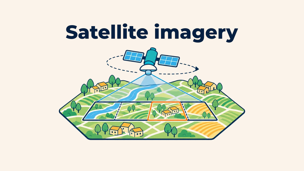
Satellite imagery is a digital raster of the Earth's surface recorded by sensors aboard orbiting spacecraft. Each raster pixel holds quantitative measurements of reflected radiance or reflectance across specific spectral bands, with every image tied to precise geographic coordinates and collection timestamps.
In GIS, satellite imagery serves as a basemap, a baseline for change detection, and raw input for analysis. However, the "newest" or "clearest" image is not always the best choice: data providers, dates, coverage, and licensing must match project requirements.
How satellite imagery is produced
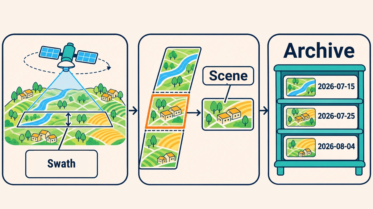
As an Earth observation satellite moves along its orbit, onboard detectors continuously scan a ground strip. The width of this path is the swath: measuring 290 km for Sentinel-2 and 185 km for Landsat 8/9. Downlinked raw signals undergo radiometric and geometric corrections before being partitioned into discrete scenes or tiles for distribution.
Consequently, an individual scene captures an exact snapshot in time. Atmospheric conditions like cloud cover, smoke, snow, and solar elevation determine scene utility for specific geographic analyses.
Open and commercial sources
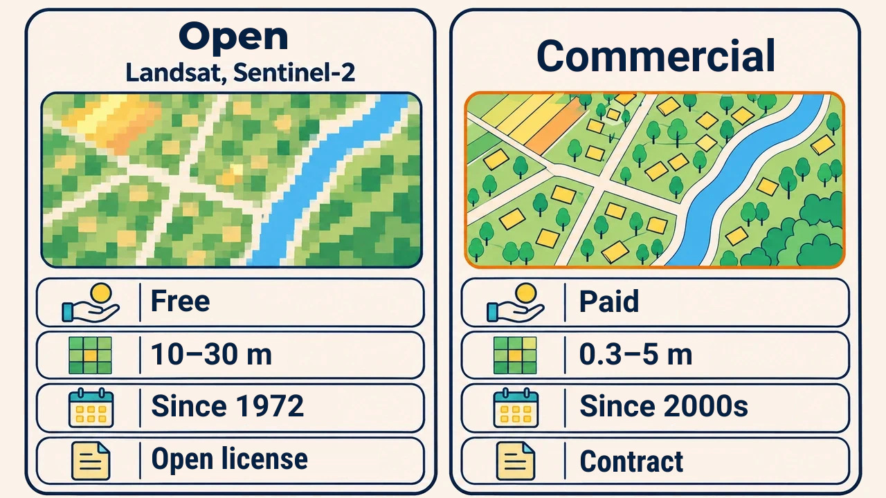
Satellite data providers fall into two primary categories. Open sources encompass public space agency programs providing freely accessible global observations. According to the USGS, the Landsat archive has been free since 2008; Copernicus Sentinel also distributes data under open, non-restrictive licenses.
Commercial sources are operated by private aerospace companies. They deliver sub-meter resolutions and on-demand collections, but require fee payments and enforce restrictive licensing agreements limiting redistribution.
| Criterion | Open sources (Landsat, Sentinel-2) | Commercial sources |
|---|---|---|
| Cost | Free of charge | Paid per area or subscription |
| Pixel size | 10–30 m | 0.3–5 m |
| Archive depth | Landsat: unbroken since 1972 | Mostly from the early 2000s onwards |
| Licensing | Free reuse and redistribution | Governed by restrictive agreements |
Value of historical archives
A major advantage of satellite Earth observation is its historical archive. The Landsat program has operated continuously since the launch of Landsat 1 in 1972, providing an unprecedented multi-decadal record of global environmental change.
For instance, analysts can examine the desiccation of the Aral Sea since the 1970s, urban expansion across Tashkent, or agricultural development in Mirzachul using consistent sensor lineages. When conducting multi-temporal comparisons, selecting imagery from matching seasons prevents normal phenological variations from being misinterpreted as long-term change.
Criteria for selecting imagery
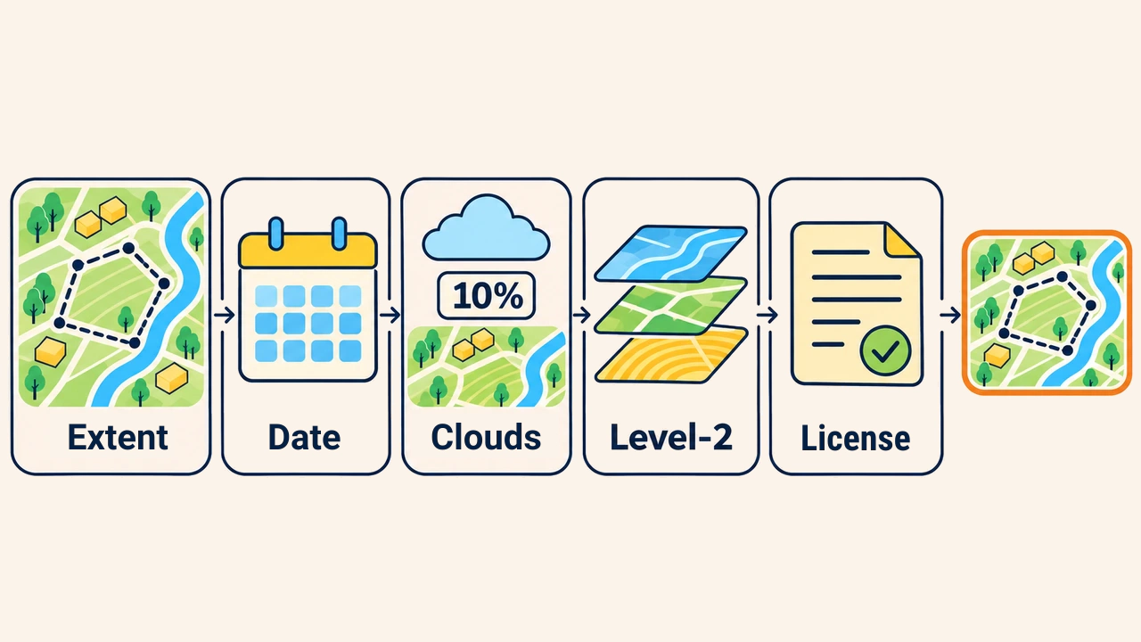
Before querying archives, define project questions and evaluate these criteria:
- Geographic extent — does the study area fit within a single scene, or is a mosaic required;
- Date and season — in which month does the target process manifest most clearly;
- Cloud cover — evaluate cloud cover directly over the study boundary rather than the scene-wide average;
- Processing level — analytical workflows require atmospherically corrected Level-2 surface reflectance products;
- Resolution and licensing — match pixel size to feature dimensions and verify distribution rights.
Imagery can be filtered by coordinates, dates, and cloud thresholds via platforms like USGS EarthExplorer and Copernicus Browser.
Common mistakes in image selection
A frequent mistake is using free web basemap imagery as analytical input. Web basemaps are composite mosaics stitched from multiple dates and sensors, lacking calibrated spectral bands and timestamps. Quantitative index modeling requires calibrated source scenes.
Another common oversight is failing to preserve scene metadata. If sensor IDs, collection dates, product levels, and scene names are omitted from technical documentation, analyses cannot be audited or replicated.
Conclusion
A satellite scene provides calibrated measurements of the Earth's surface at an exact point in time. Open sources provide multi-decadal archives and open licenses, while commercial missions offer sub-meter resolution for small infrastructure.
Selecting suitable imagery starts with project goals: verify geographic coverage, season, local clouds, processing levels, and licensing terms while archiving complete metadata alongside spatial layers.