What is remote sensing?
Introduction
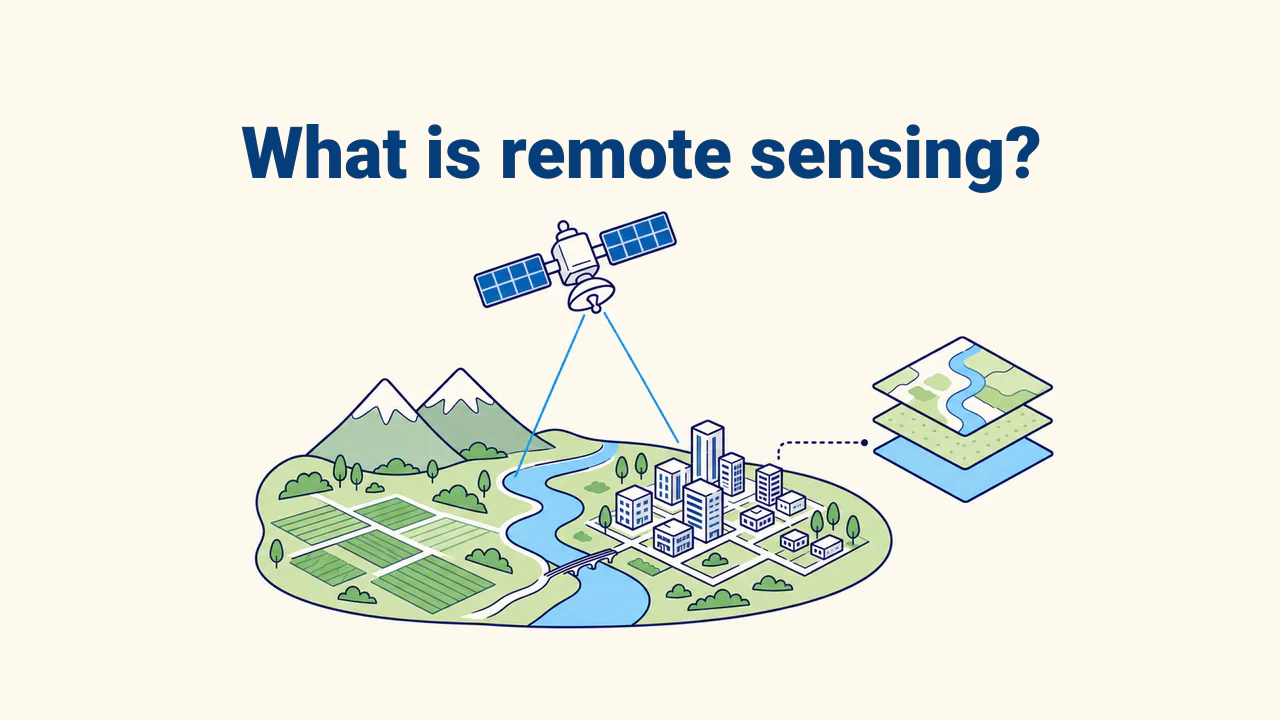
Remote sensing is the method of acquiring information about an object or area without direct physical contact. A sensor on a satellite, aircraft, or drone measures energy reflected or emitted by the Earth's surface, creating a digital image with far greater depth than a standard photograph.
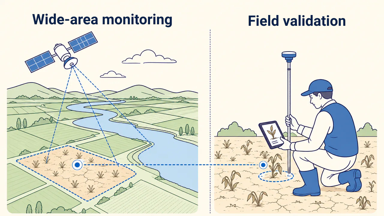
This method enables repeated monitoring of expansive territories, detection of subtle spectral differences, and comparison of conditions across dates. Remote sensing does not replace field observations; it highlights where and what requires detailed inspection.
How does observation work?
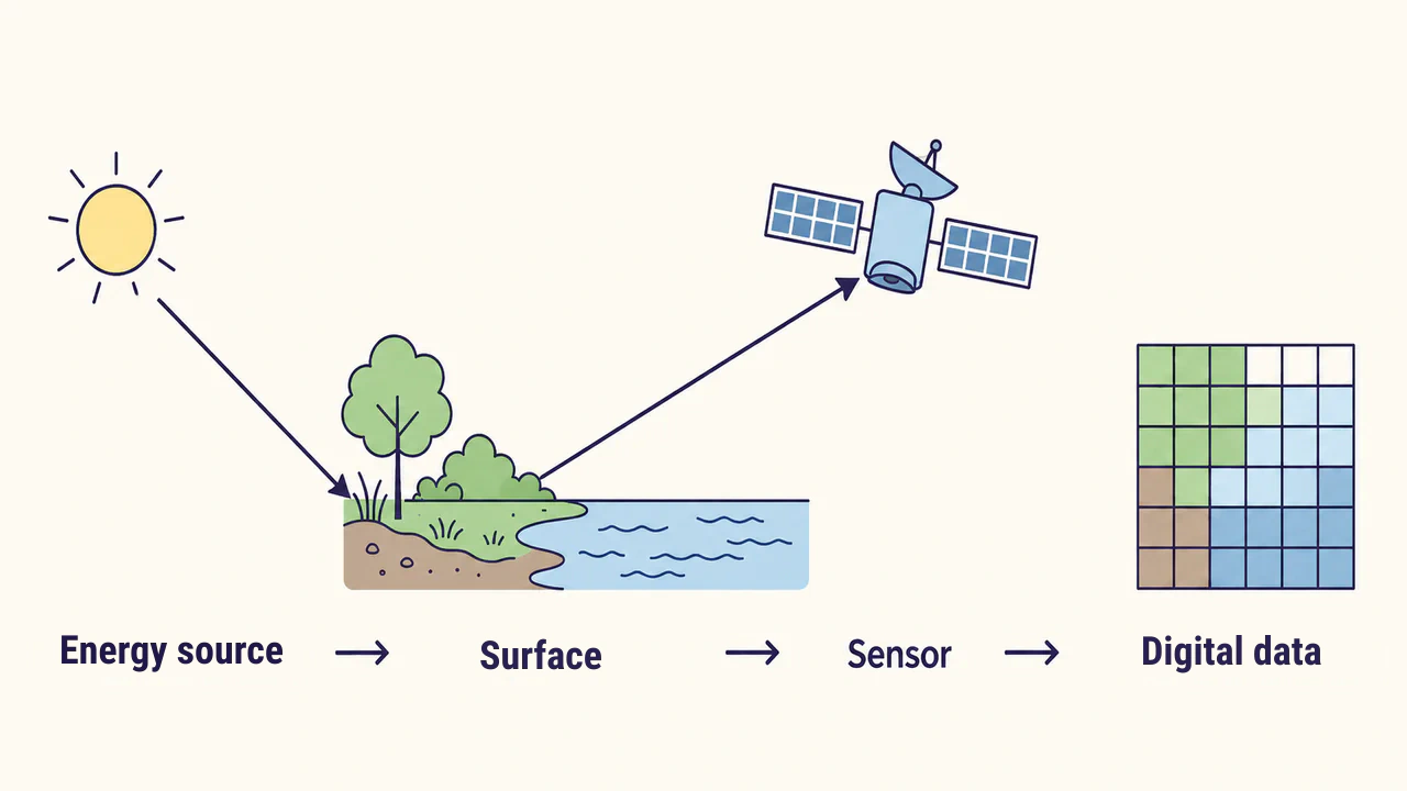
Water, soil, vegetation, and man-made materials reflect or emit energy in distinct ways. A sensor records these differences across specific spectral ranges. In NASA's definition, remote sensing is described as detecting and measuring radiation of different wavelengths reflected or emitted from distant objects.
Passive sensors typically capture reflected sunlight or thermal radiation emitted by the Earth's surface. Active sensors emit their own signal and measure the reflected portion. In both cases, sensor measurements become pixel values. A pixel is not merely a color, but a digital measurement for a specific ground area and spectral band.
Platform, sensor, and image
A platform is the vehicle carrying the sensor: a satellite, aircraft, drone, or ground system. A sensor is the instrument that detects energy and converts it into measurements. An image is the digital representation of these measurements arranged in rows and columns. Keeping these three concepts distinct helps properly evaluate any data source.
The platform determines coverage and revisit frequency; the sensor dictates which energy bands and levels of detail are recorded. Selecting imagery requires evaluating acquisition date, cloud cover, pixel size, spectral bands, and processing level rather than visual appearance alone.
Connection to GIS
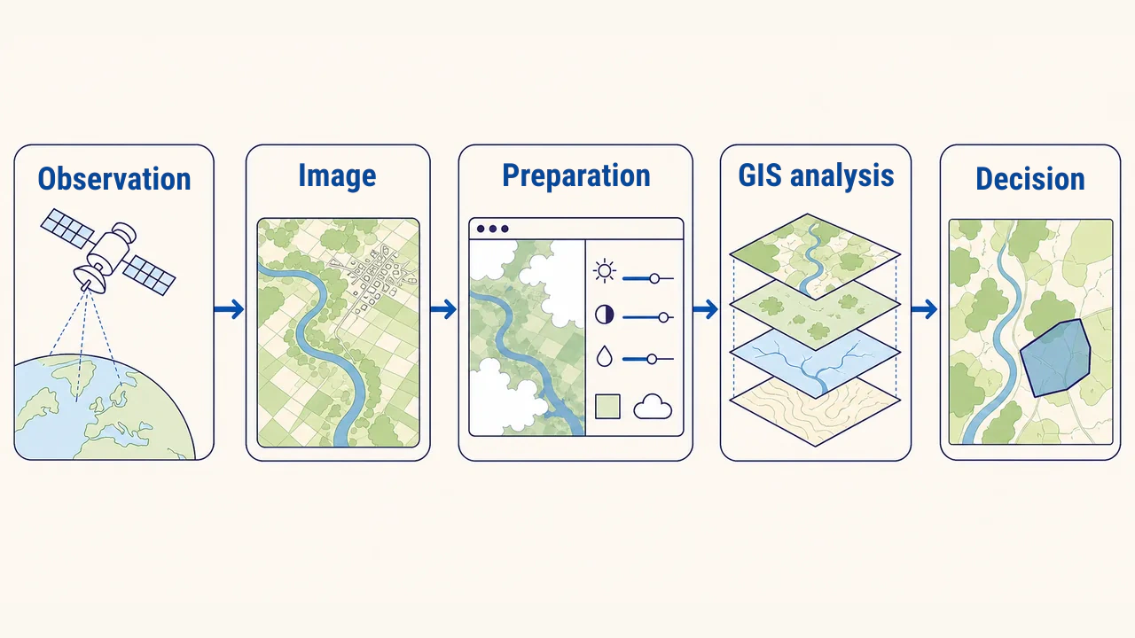
Remote sensing provides observational data, while GIS links it with other spatial layers for comprehensive analysis. When an image has a defined coordinate reference system, administrative boundaries, roads, fields, or hydrological networks can be overlaid onto it. Information extracted from imagery is then correlated with specific ground features.
For example, an image may detect variations in crop health, while GIS calculates which specific farm fields those variations belong to. The outcome can be an analytical table, a map, or a prioritized list of inspection sites. Thus, an image is not a final decision, but an essential source for spatial analysis.
Where is it applied?
Remote sensing is used to monitor crops, assess water bodies, detect land cover change, map wildfire and flood scars, and analyze urban sprawl. In examples from the USGS, tracking major wildfires, cloud patterns, volcanoes, agriculture, and long-term forest change is highlighted.
In Uzbekistan, assessing irrigated fields across multiple districts in a single day shows the coverage benefits of remote observation. However, a spectral shift on an image does not immediately mean a water deficit: crop type, growth stage, soil, and acquisition date also influence appearance.
Interpretation and quality control
Spatial resolution determines the ability to resolve small features, while spectral bands differentiate materials. Clouds, shadows, atmospheric conditions, sensor noise, and geometric distortion can cause erroneous conclusions. When comparing multi-temporal imagery, season, observation hour, and processing level must match as closely as possible.
In professional practice, the analytical question is defined first, and suitable imagery is chosen. Data source and metadata are verified, preprocessing is performed, and results are compared with GIS layers. Questionable areas are confirmed using higher-resolution sources or field samples. Rather than judging by color alone, measurement lineage and limitations are documented.
Conclusion
Remote sensing measures reflected or emitted energy from the Earth's surface across distances, creating digital data about a territory. The platform carries out observation, the sensor measures energy, and GIS integrates images with other spatial layers to produce actionable insights.
Reliable results depend on selecting appropriate imagery, accounting for sensor limitations, and verifying critical findings through independent sources or field inspections.