Setting up a Python GIS environment
Introduction
A virtual environment is an isolated Python interpreter and library sandbox dedicated to a specific project, separated completely from global system packages. In geospatial development, this isolation is critical: spatial modules do not run as standalone pure Python, but bind directly to compiled C and C++ system libraries.
If an environment is misconfigured, scripts fail on other machines, raise import exceptions, or perform coordinate transformations with subtle, undetected positional drift. A clean, reproducible environment is the foundation of dependable GIS programming.
Why an isolated environment is necessary
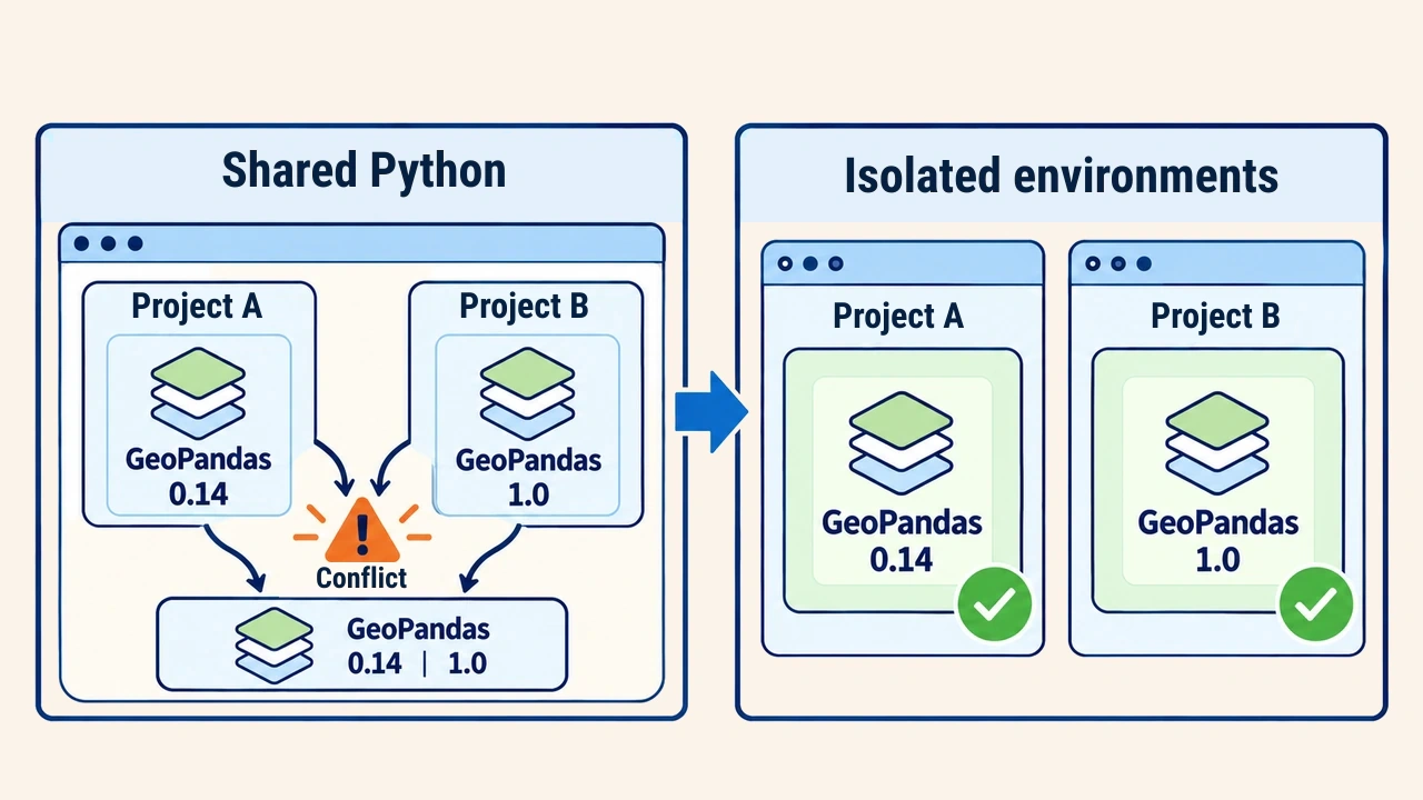
In a single shared Python installation, conflicting project requirements inevitably clash. If one analysis requires the latest GeoPandas release while an established pipeline depends on a legacy version, they cannot coexist in a single environment. Furthermore, desktop applications like QGIS and ArcGIS Pro embed their own internal Python runtimes; injecting external packages into those system folders risks corrupting the GIS application itself.
In dedicated virtual environments, every project preserves its specific compatible versions. If an environment breaks, removing and rebuilding it from a declarative specification takes only minutes, making technical experimentation safe.
The spatial library stack
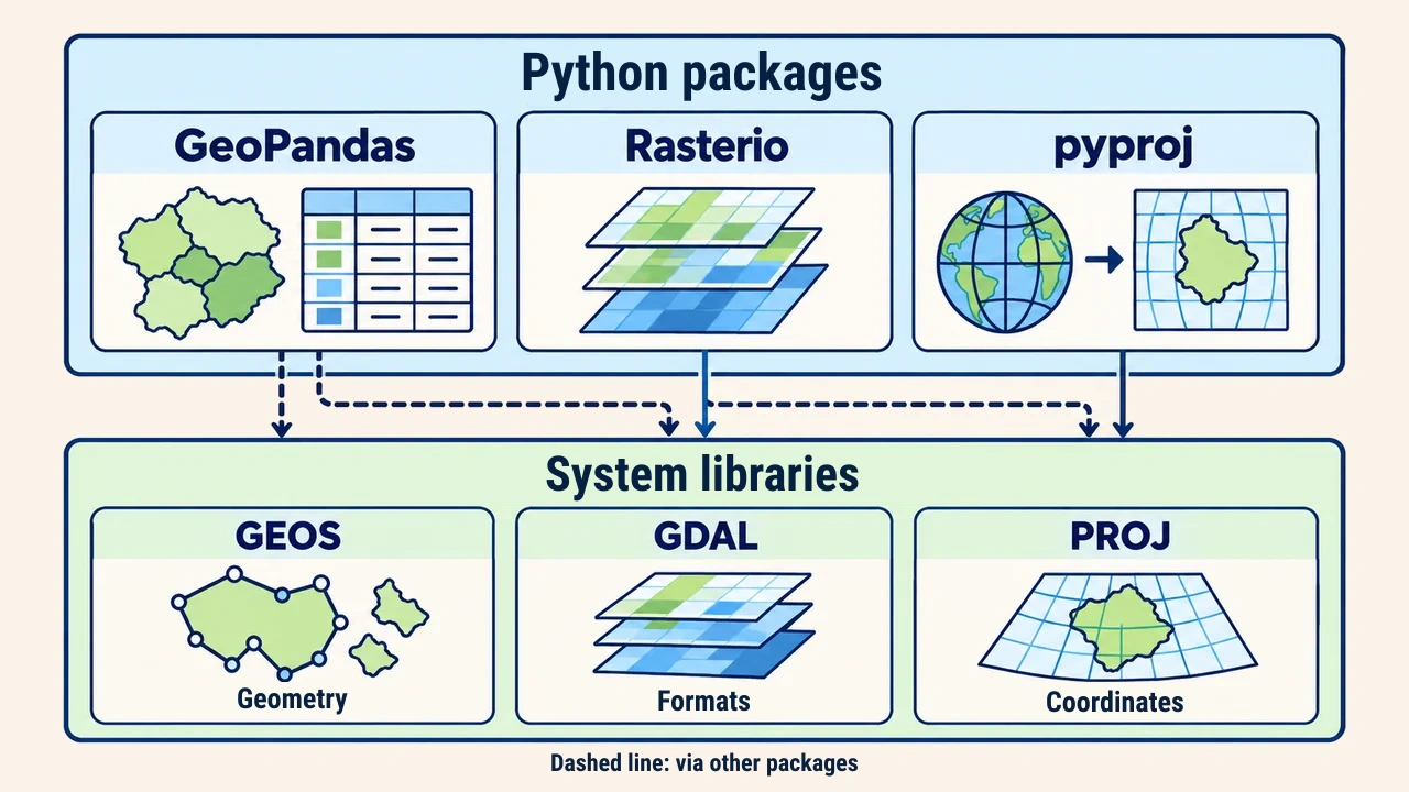
GeoPandas, Rasterio, and pyproj serve as high-level Python interfaces. Beneath them operate three foundational system libraries: GDAL reads and writes vector and raster formats, PROJ performs coordinate transformations, and GEOS computes planar geometric operations like intersections and buffers. Python packages and underlying C libraries must match across exact binary versions.
Two primary packaging pathways exist. The conda package manager installs compiled C system libraries alongside Python packages as an integrated, compatible stack; spatial developers rely on the community-maintained conda-forge channel. By contrast, pip retrieves pre-compiled wheels from PyPI. While modern pip wheels often bundle compiled binaries, differing GDAL or PROJ versions embedded across distinct packages can trigger runtime collisions. GeoPandas documentation explicitly recommends installation through conda-forge.
Creating the environment
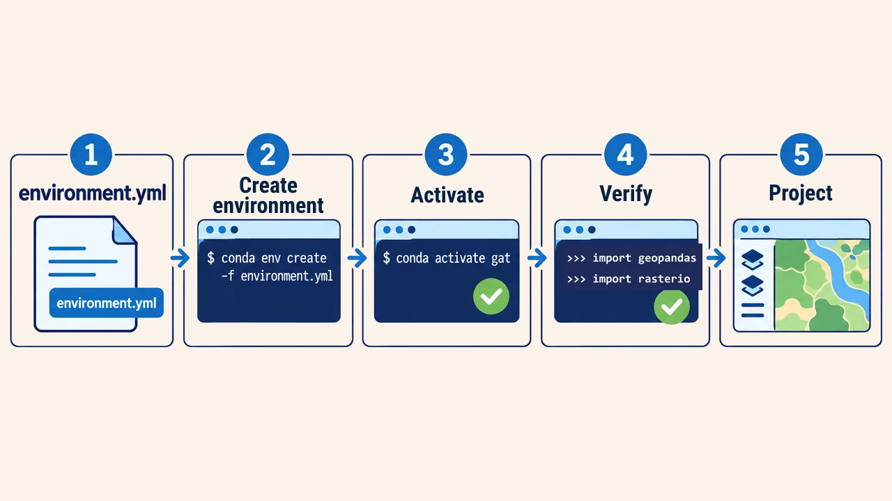
To deploy conda, the lightweight Miniforge installer is ideal, configuring conda-forge as its default channel. In the project root, create an environment.yml specification:
name: gat
channels:
  - conda-forge
dependencies:
  - python=3.12
  - geopandas
  - rasterio
  - pyproj
  - jupyterlab
Next, build and activate the environment via the terminal:
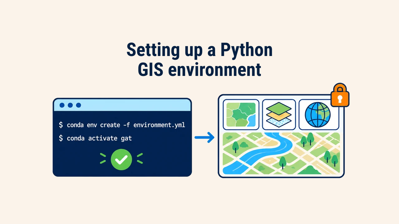
conda env create -f environment.yml
conda activate gat
This configuration file is versioned in the project repository. Collaborators can recreate an identical environment using this single manifest. When exact lockfile reproducibility is required, export active packages using conda env export.
When adding new packages, edit environment.yml first, then run conda env update -f environment.yml to keep environment states aligned with documentation. If an environment becomes corrupted, remove it with conda env remove -n gat and rebuild it directly from the file. Project datasets remain untouched because they reside outside the environment.
Verifying the installation
Once the environment is active, verify that spatial libraries operate properly:
import geopandas as gpd
import rasterio
from pyproj import Transformer

gpd.show_versions()
t = Transformer.from_crs("EPSG:4326", "EPSG:32642", always_xy=True)
print(t.transform(69.28, 41.31))
show_versions() prints the exact releases of Python, GeoPandas, GDAL, PROJ, and GEOS. The coordinate transformation converts Tashkent coordinates into metric UTM zone 42N coordinates; the resulting values should be roughly 523,000 meters Easting and 4,573,000 meters Northing. Import errors or large numeric discrepancies flag library incompatibility.
Common mistakes
The most frequent error is mixing conda and pip commands without strict separation. Pip installations can overwrite compiled conda binaries, breaking links to PROJ or GEOS. If a library is unavailable on conda-forge, install it with pip strictly as the final step.
A second issue is running the wrong interpreter when an IDE or terminal invokes system Python rather than the active environment. Running python -c "import sys; print(sys.executable)" identifies the active binary path. A third issue involves proj.db not found errors, which typically signify conflicting PROJ paths on a single machine and are resolved by rebuilding the environment cleanly.
Conclusion
Geospatial programming in Python demands an isolated project environment ensuring compatibility with low-level spatial libraries. Conda-forge and declarative environment.yml files enable seamless replication across machines.
Running a quick verification script with version checks and test coordinate transformations is a brief habit that prevents hidden analytical errors later in development.