Coordinate systems in GIS, CRS, and reprojection
Introduction
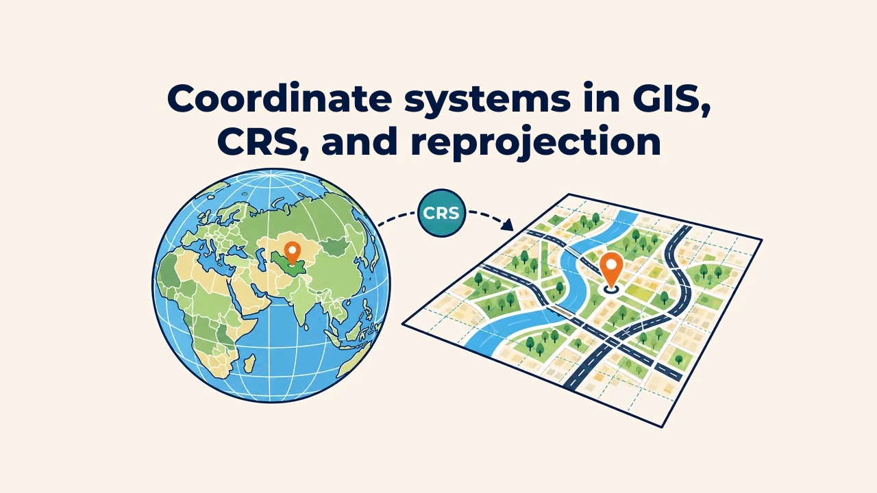
A coordinate reference system (CRS) is a framework of rules binding coordinates to real locations on Earth. For example, 41.31, 69.28 cannot reliably represent a point in Tashkent without knowing axis order, units, and geodetic datum.
Desktop GIS can align layers with differing coordinate systems on screen. However, visual alignment does not mean data is ready for analysis. In distance, area, buffer, and overlay operations, CRS choice directly affects accuracy.
What is a CRS composed of?
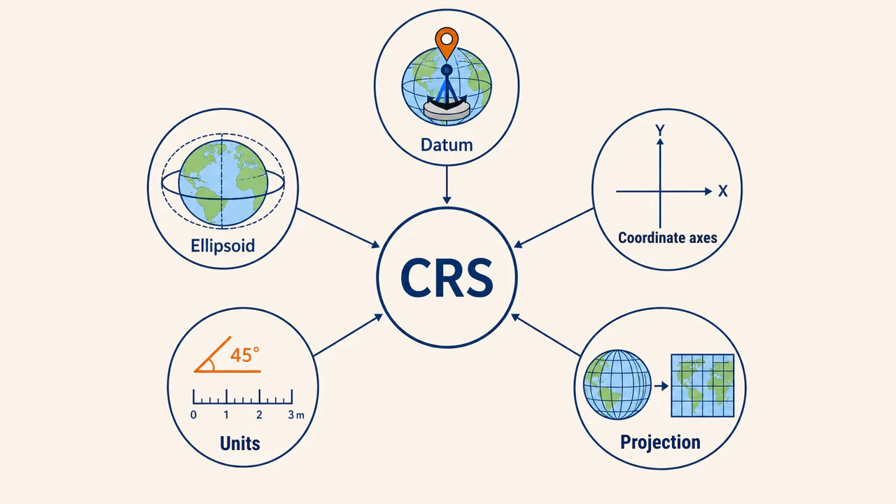
A coordinate system consists of more than X and Y coordinates. A full CRS integrates:
- datum — the geodetic foundation anchoring coordinates to Earth;
- ellipsoid — mathematical model of Earth's shape;
- coordinate system — axes, orientations, and sequence;
- units — degrees, meters, or other measures;
- projection — formulas mapping curved surfaces onto a plane.
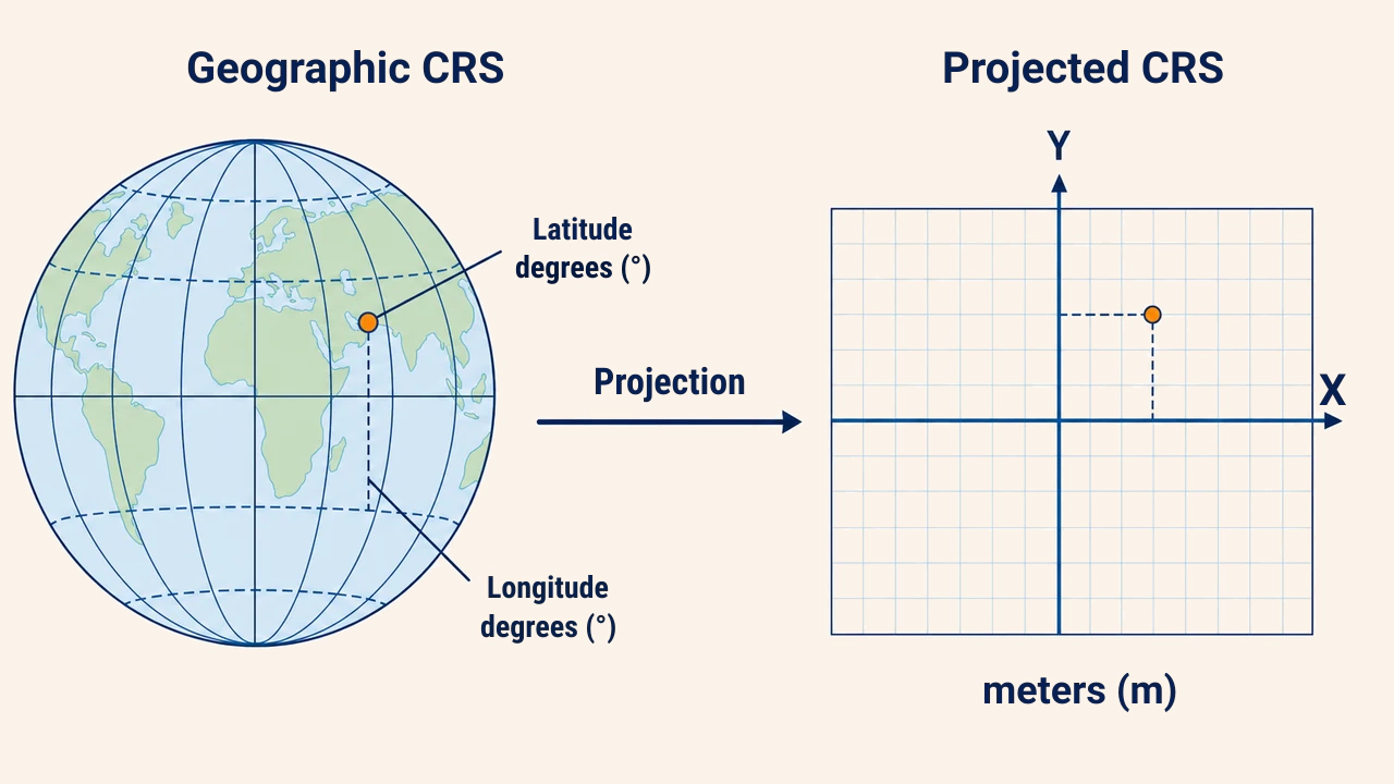
A geographic CRS lacks a projection, whereas a projected CRS combines a datum with a map projection. Parameters are stored in text formats like Well-Known Text (WKT) or referenced by EPSG codes. The OGC WKT standard defines the structure of coordinate operations.
Geographic vs. projected CRS
A geographic CRS defines locations across an ellipsoidal surface using latitude and longitude, measured in angular units (degrees). For instance, the WGS 84 2D geographic system is cataloged as EPSG:4326. It serves as the global standard for location exchange, but degrees cannot be treated as planar metric units for distance or area computations.
A projected CRS translates coordinates into planar metric X and Y positions, typically measured in meters. Every projection preserves certain properties (distance, area, angle, or shape) at the expense of distorting others. Therefore, projections must be selected to match regional geography and analytical goals. EPSG:3857 is tailored for web map visualization; the EPSG registry cautions against using it for precise local engineering or metric area measurements.
What does an EPSG code signify?
An EPSG code is a unique identifier assigned to a geodetic parameter dataset record. The code represents far more than a title: its entry details the underlying datum, coordinate axis order, measurement units, and geographic area of use. Two coordinate systems sharing similar names may possess different datums or reversed axis orders.
Selecting a CRS merely by scanning for labels like "WGS 84" or "UTM" is risky. Analysts must examine the complete name, EPSG code, area of use, units, and accuracy specifications. A system chosen for local spatial analysis must properly envelope the project footprint.
Assigning CRS vs. reprojection
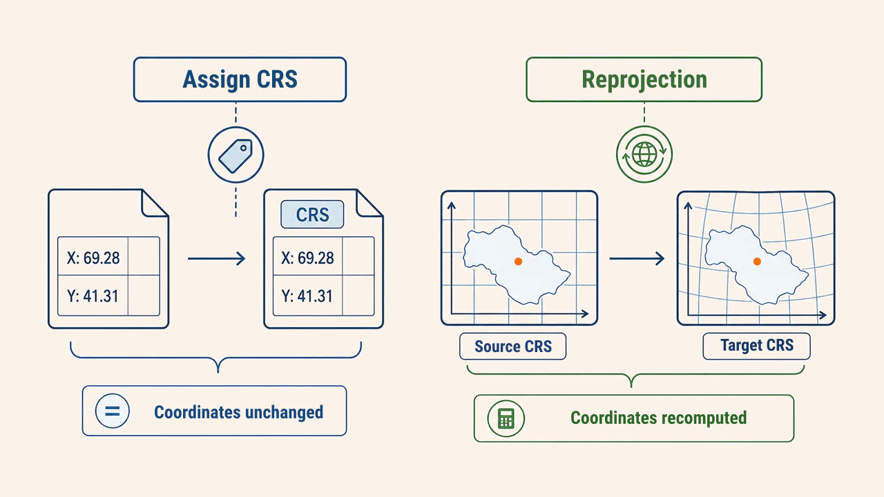
Assigning a CRS (assign CRS) leaves coordinate numbers unchanged; it merely updates metadata to indicate how numbers are interpreted. This applies only when a layer's true CRS is known but unassigned or mislabeled. Assigning an arbitrary CRS displaces features to false locations.
Reprojection (reproject) recomputes coordinates from a source CRS to a target CRS, creating a new dataset. The source CRS must be defined correctly first. If datums differ, software offers transformation options; selection depends on region, expected accuracy, and grid availability.
Practical workflow
A rigorous spatial workflow follows these stages:
- identify the true CRS from layer metadata or authoritative documentation;
- verify coordinate value ranges, axis order, and units logically;
- select an appropriate metric projected CRS covering the project area;
- choose a verified geodetic transformation when crossing datums;
- export vector layers to the new CRS, and transform rasters using appropriate resampling;
- validate layer alignment, control points, and distances on the map.
On-the-fly CRS transformation in QGIS reprojects layers dynamically for viewport display, but leaves underlying files unchanged. For multi-layer geoprocessing, exporting all inputs to a shared regional projected CRS ensures reproducible and defensible outcomes.
Errors and quality assurance
The most common error is guessing an EPSG code when encountering an undefined layer. The second is assuming layers share a CRS simply because they align visually on screen. The third is executing metric buffers or area calculations directly on layers defined in angular degrees.
Reprojecting rasters computes new grid cell values. For categorical data like land cover, nearest neighbor resampling preserves class integers; for continuous surfaces, bilinear or cubic interpolation produces smoother transitions. In all cases, verify target pixel size, NoData definitions, and spatial registration.
Conclusion
A CRS provides geometric numbers with true geographic meaning, while map projections govern how the curved Earth is portrayed on flat maps. Geographic systems are ideal for global positioning, whereas regional projected systems are necessary for accurate spatial measurement and modeling. Sound GIS workflows rely on distinguishing between assigning and reprojecting coordinate systems, confirming transformation boundaries, and rigorously verifying geometric alignment.