Spatial databases
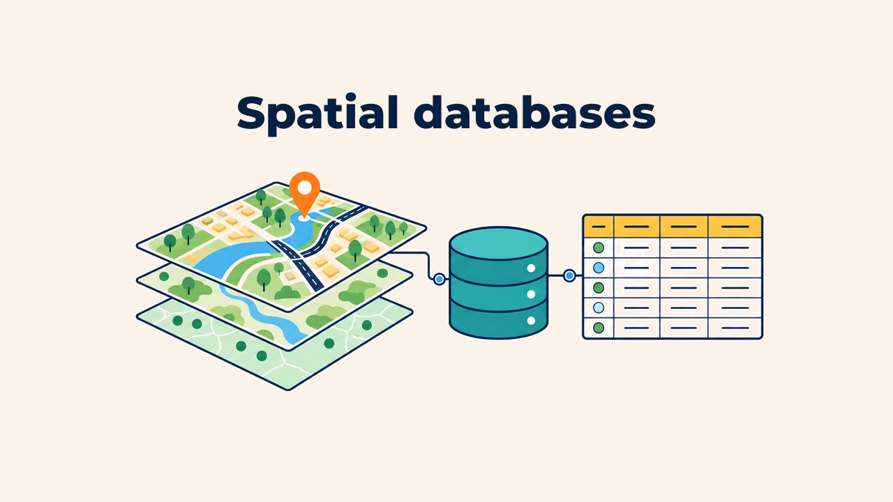
Introduction
A spatial database is a system that organizes geographic features, attribute tables, relational connections, and governance rules within a unified structure. It is far more than a folder of map files: it dictates where information resides, how datasets connect, and which users can modify records.
When land parcels, buildings, roads, and ownership records are stored as disconnected shapefiles, maintaining their consistency manually becomes tedious and error-prone. A spatial database coordinates these assets through a shared schema and relational keys.
Difference from standalone files
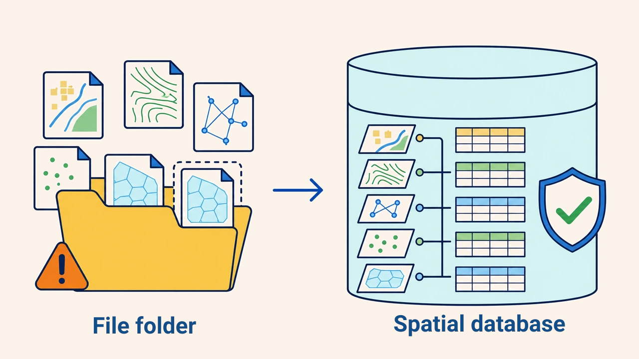
In a file-based folder, each layer lives as an isolated file. Files can be accidentally relocated, renamed, or overwritten with outdated revisions, leaving relationships documented only in external text or memory. When multiple colleagues edit duplicate files simultaneously, determining the authoritative version is difficult.
In a database, layers and tables conform to a predefined schema. The schema formalizes column headers, data types, mandatory constraints, and table relationships. Centralized storage reduces duplicate copies. However, a database does not automatically ensure quality: an ill-conceived schema merely preserves mistakes in an orderly layout.
Database architecture
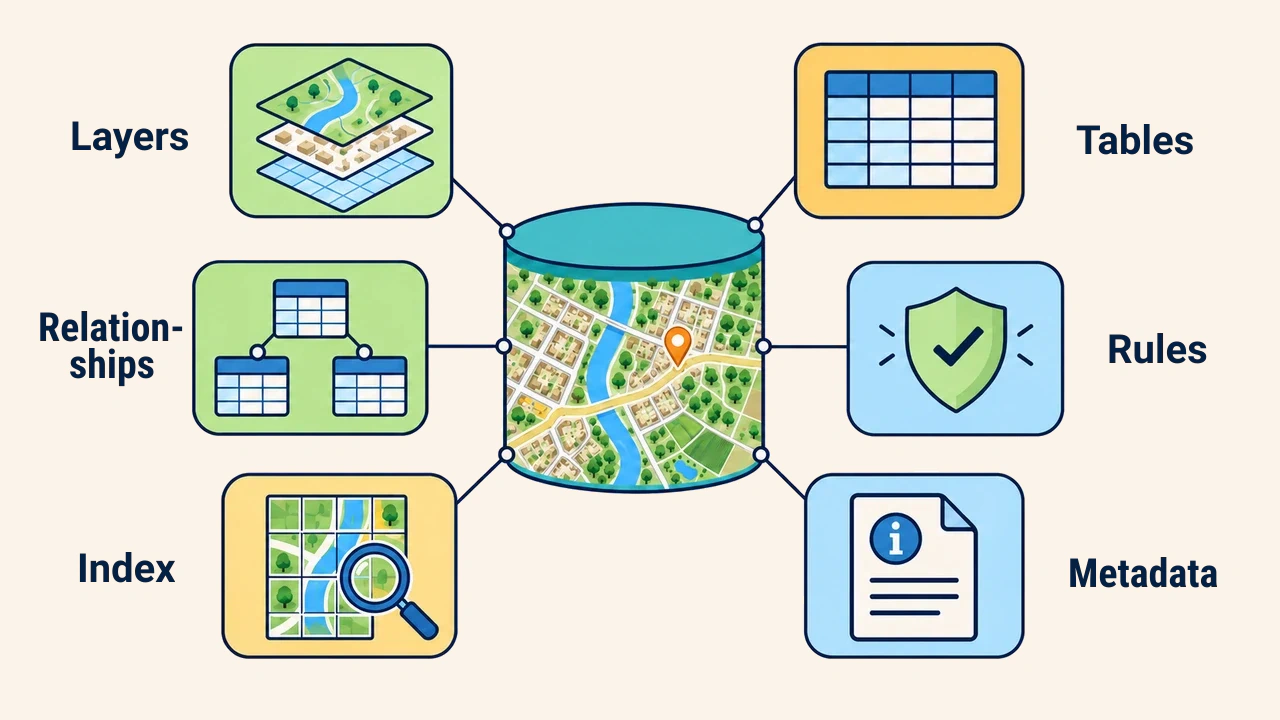
The core components of a spatial database comprise spatial layers, non-spatial tables, relationships, integrity constraints, and metadata. A layer stores point, line, or polygon geometries alongside attributes. Tables store related records like addresses, legal owners, or inspection logs.
Coordinate reference systems, geometry types, and field definitions form the schema foundation. A spatial index accelerates feature retrieval based on location without altering geometries. Metadata documents source lineage, update dates, measurement accuracy, responsible agencies, and licensing constraints.
Relationships and identifiers
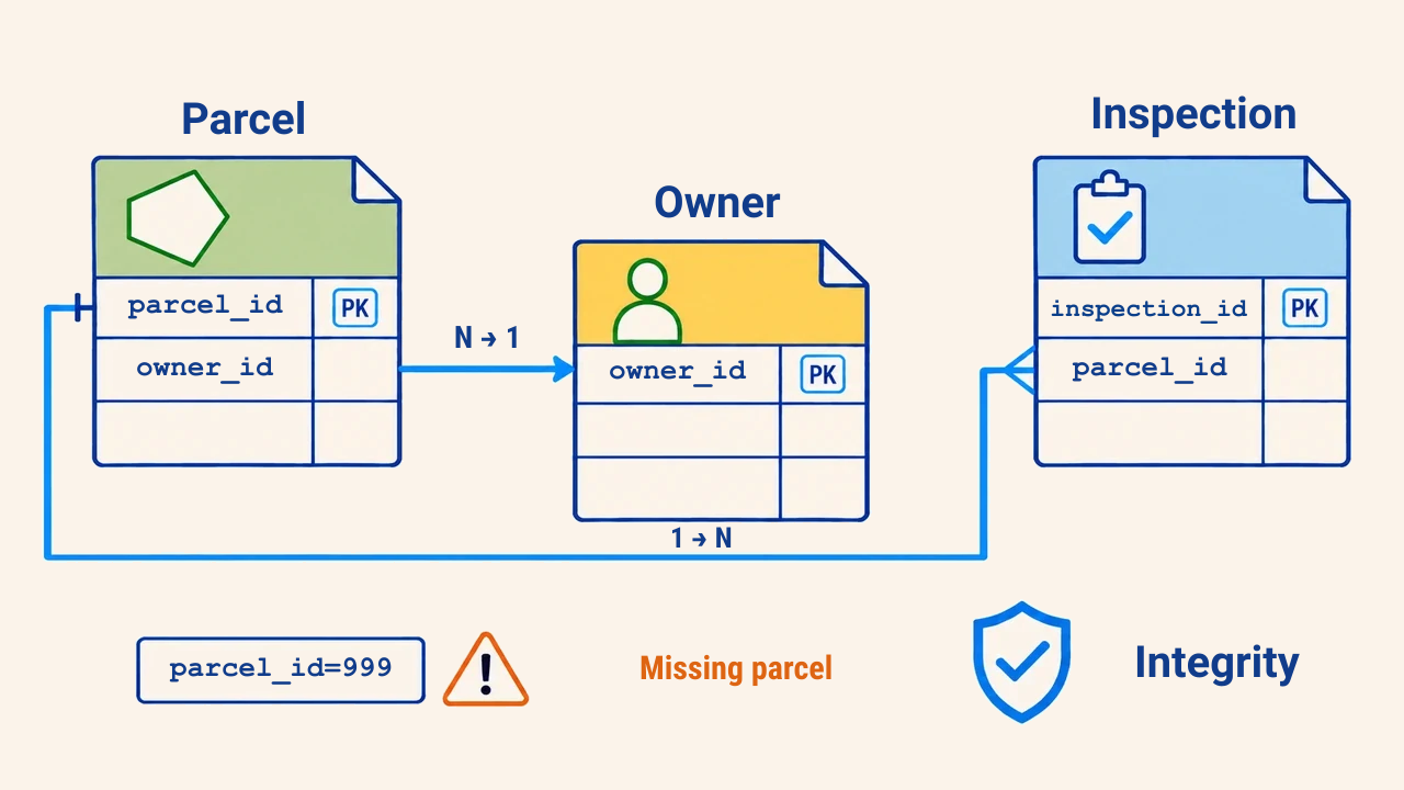
Database tables connect via shared keys. If a unique parcel_id in a land parcels table matches a foreign key in an inspections table, software joins all inspection logs to the corresponding parcel. Because multiple inspections apply to a single parcel, this forms a one-to-many relationship.
Using descriptive names as keys is risky: names duplicate or alter in spelling. Stable, immutable primary keys are detached from human labels and preserved during edits. Unlinked orphan records, duplicate keys, and invalid foreign keys should be audited regularly.
Rules and data integrity
Data integrity represents a state where database values and relationships strictly adhere to business rules. For example, road classes must be selected from a verified lookup domain, mandatory primary keys cannot remain null, and district codes must exist in the administrative boundary table.
Spatial rules govern geometry: parcel polygons must not overlap without cause, pipeline junctions must snap to lines, and building footprints must fall completely within zone boundaries. Rules are configured to match project goals rather than applied blindly.
Multi-user collaboration
Enterprise databases enable concurrent multi-user editing across shared datasets. A transaction groups interdependent edits into a single atomic operation: if all updates succeed, they commit; if an error occurs, the transaction rolls back completely to prevent data corruption.
Role-based permissions govern whether users can view, insert, edit, or delete features. Edit conflict resolution, automated backups, and disaster recovery procedures are established beforehand. A single GeoPackage file suits small standalone projects, while multi-user server databases offer scalable control.
Database design and quality control
Design begins by mapping real-world entities and operational workflows. Schemas are formalized with geometry types, attribute fields, foreign keys, relationships, and permissions. Redundancy is minimized through normalization, though excessive table splitting can hinder query performance.
Test datasets validate feature creation, editing, relational joins, and deletion cascades. Quality audits check duplicate keys, null values, orphan records, invalid geometries, and CRS alignment. Documenting schema revisions, change reasons, and author logs ensures long-term database maintainability.
Conclusion
A spatial database does not merely store spatial layers together; it manages their architecture, relationships, quality standards, and user access. Reliable solutions rely on immutable keys, explicit schemas, tailored integrity rules, and disciplined backup routines. Choosing a database matched to project scale turns raw spatial data into an enduring corporate asset.