Passive and active remote sensing
Introduction
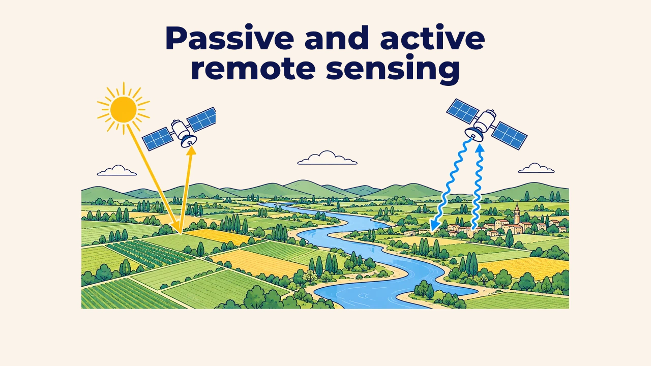
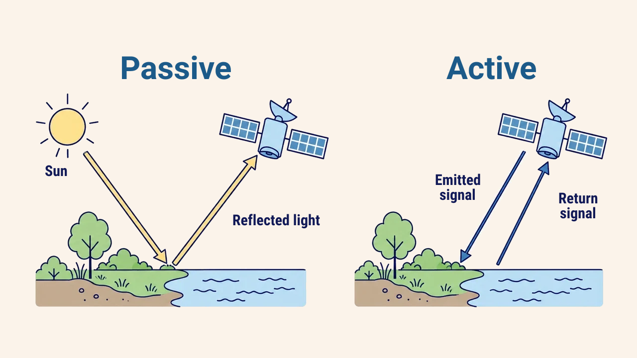
Passive remote sensing is an observation method where sensors record naturally available energy, primarily reflected solar radiation or thermal energy emitted by the Earth's surface. In contrast, active remote sensing instruments supply their own energy source, directing pulses toward the surface and recording returning backscatter.
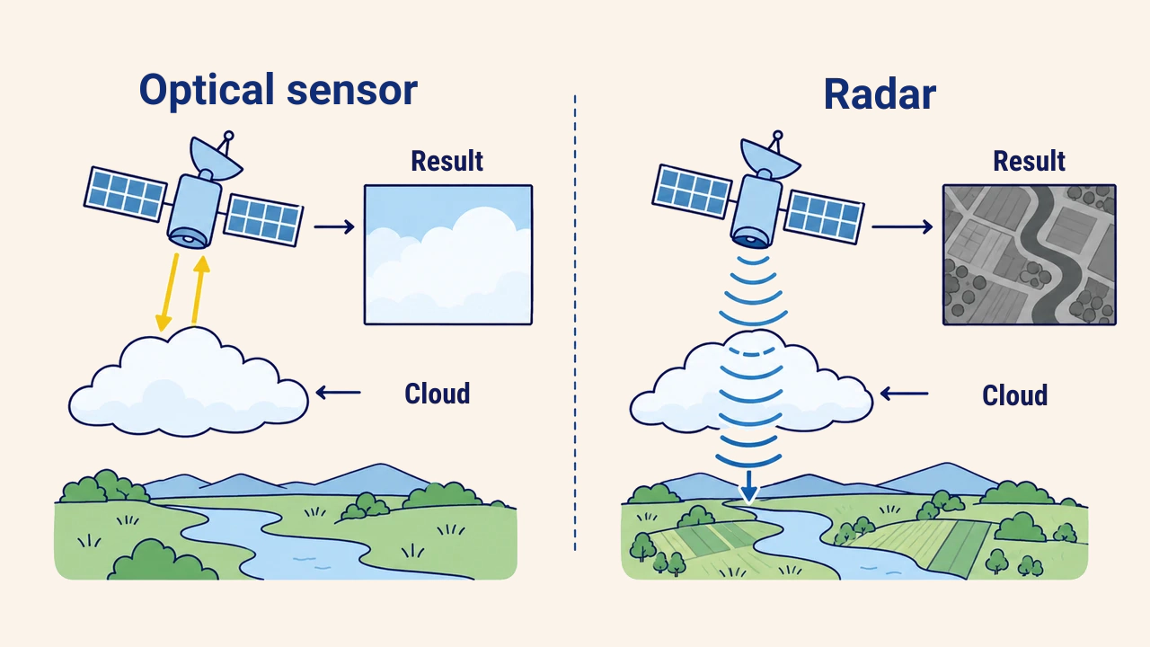
This fundamental difference determines when data collection is possible. During heavy cloud cover, at night, or when precise topographic elevations are required, choosing the wrong sensor category leads to data gaps or unanswerable questions.
How passive sensors work
Optical sensors measure reflected sunlight across visible, near-infrared, and shortwave infrared wavelengths. Familiar instruments include the OLI sensors aboard Landsat 8–9 and the MSI instruments on Sentinel-2. Their imagery is intuitive, separating vegetation, water bodies, and urban structures based on distinct spectral signatures.
Thermal infrared sensors are also passive, yet they capture thermal radiant energy emitted directly by the ground rather than reflected sunlight. Consequently, instruments like Landsat's TIRS can map land surface temperatures both day and night.
The primary limitation of passive remote sensing is atmospheric interference. Optical and thermal wavelengths cannot penetrate clouds, while haze and dust attenuate incoming radiation. Optical sensors also depend strictly on solar illumination; nighttime visible imagery cannot map surface cover.
Active systems: radar and LiDAR
Radar emits microwave pulses, measuring backscatter intensity and time delay. In satellite remote sensing, Synthetic Aperture Radar (SAR) serves as the primary configuration. Microwave wavelengths penetrate clouds, rain, and haze effortlessly, and because instruments generate their own illumination, they operate day and night. The European Space Agency's Sentinel-1 mission continuously collects C-band SAR imagery worldwide.
LiDAR (Light Detection and Ranging) emits laser pulses, measuring round-trip travel times to calculate distances. The resulting dataset is a dense 3D point cloud with precise spatial coordinates and elevations. Because individual pulses can reflect partially from forest canopies and partially from bare ground, LiDAR measures tree heights and underlying terrain simultaneously. LiDAR operates mainly from aircraft and drones, with orbital missions like GEDI and ICESat-2 providing specialized research data.
Radar imagery does not look like optical photography. Pixel brightness reflects surface roughness, moisture, and geometry rather than visual color: smooth water appears black due to specular reflection, while angular buildings act as corner reflectors and appear bright. Interpreting radar imagery requires specialized training.
Comparing the two approaches
| Criterion | Passive (optical, thermal) | Active (radar, LiDAR) |
|---|---|---|
| Energy source | Sun or terrestrial thermal emission | Sensor's internal transmitter |
| Cloud sensitivity | Completely obscures surface | Radar penetrates; LiDAR is blocked |
| Night operations | Thermal infrared only | Yes, completely illumination-independent |
| Primary output | Spectral reflectance/radiance | Backscatter power, travel delay, 3D point cloud |
| Image interpretation | Visually intuitive | Demands specialized training |
Practical sensor selection
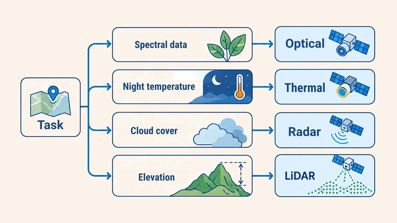
Sensor selection begins with the scientific question. When calculating crop health or vegetation indices, multispectral optical imagery is essential. When mapping seasonal floods during overcast storms, radar is superior because calm water contrasts sharply against rough land beneath thick clouds. For forest canopy structures or digital terrain models, LiDAR is the optimal choice.
Many workflows fuse both approaches. For example, when cloudy spring months interrupt optical time series, SAR acquisitions bridge the observation gap. In such workflows, acquisition dates, spatial resolutions, and coordinate reference systems must be matched before analysis.
Limitations and verification
Every remote sensing technology exhibits specific error profiles. Optical scenes can misclassify cloud shadows as water or bright soil as concrete. Radar imagery suffers from speckle noise and topographic distortions like foreshortening on mountain slopes. LiDAR data can contain false returns caused by birds or atmospheric aerosols.
Therefore, findings should be verified against independent sources: field survey records, high-resolution aerial imagery, or complementary sensor acquisitions. Processing levels, collection dates, and calibration steps must be documented in project reports. NASA Earthdata provides thorough guidelines for selecting and preprocessing SAR datasets.
Conclusion
Passive sensors measure natural radiation, providing rich spectral data that remains dependent on clear weather and daylight. Active sensors provide their own illumination: radar operates through weather and darkness, while LiDAR delivers unmatched topographic accuracy.
Sound technical decisions depend on the analytical objective, environmental conditions, and processing capabilities. Combining both approaches compensates for single-sensor limitations and provides independent verification for spatial models.