What is attribute data?
Introduction
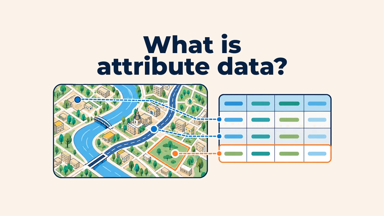
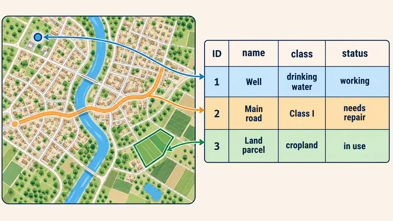
Attribute data refers to non-spatial values that describe the characteristics of geographic features. While a map identifies a well's location as a point, its name, depth, year of drilling, and operational status are maintained in an attribute table. Geometry answers "where?", while attributes answer "what is it?" and "what are its properties?".
Attributes transform static maps into queryable, computable, and structured information systems. If table design is flawed, analytical outputs will remain untrustworthy even with precise geometry.
How is an attribute table structured?
In a vector layer's attribute table, each row corresponds to a single spatial feature, while each column represents a specific property. For example, in a road layer, a row represents a distinct road segment, and columns like name, type, length_m, and surface record its characteristics.
Column headers — field names — must remain concise, unambiguous, and standardized. Arbitrary labels like field1 or new obscure meaning. Explicit units in field names or metadata are beneficial: length_m indicates meters and area_ha hectares. Giving every feature a unique identifier eases editing, table joins, and quality assurance.
Field types and data values
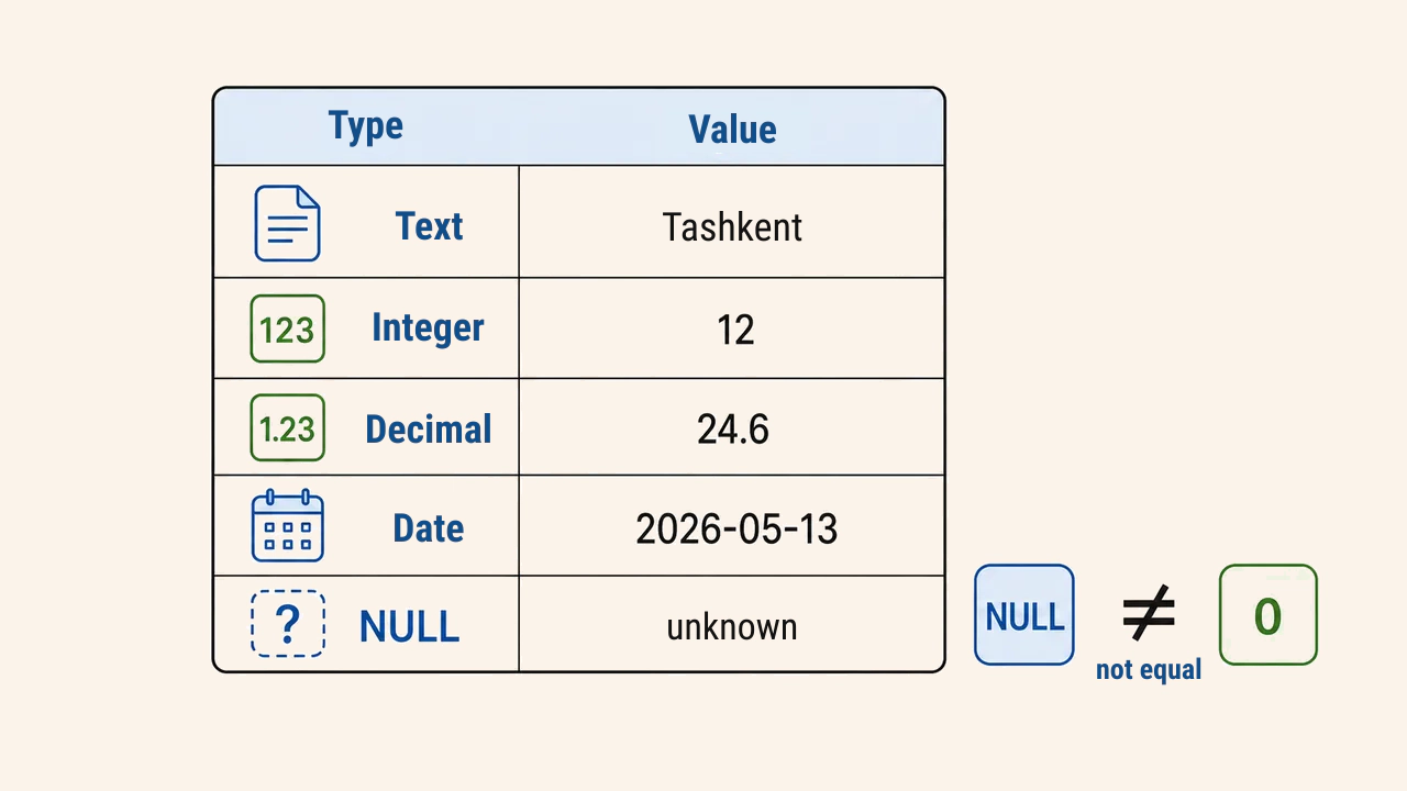
Field types define stored values and valid computational operations. Text stores names and alphanumeric codes, integer records counts, float/double holds metric measurements and coordinates, and date/time records timestamps. Binary states are captured via booleans or standardized codes.
Storing numeric IDs in text fields causes values like 2, 10, 100 to sort alphabetically rather than numerically. Conversely, postal codes and classification codes requiring leading zeros must remain text. A NULL value represents unknown or missing data; it is fundamentally distinct from zero or an empty string.
Linkage with geometry
Selecting a feature highlights its spatial shape alongside its table row. Editing attribute values updates descriptive properties without moving coordinates. Conversely, editing vertices alters shape or position while retaining tabular records in place.
This one-to-one link must remain intact. Deleting a feature removes its corresponding row; digitizing a new feature creates a record. Arbitrary editing in external spreadsheets or corrupted keys can desynchronize tabular values from spatial geometries.
Querying and calculations
An attribute query filters features based on logical criteria. For instance, status = 'damaged' isolates degraded roads, while population > 10000 selects major urban settlements. Operators evaluate text, numbers, and dates differently, making field types and NULL handling critical.
The field calculator generates new columns via mathematical expressions: converting meters to kilometers, computing elapsed time between dates, or standardizing category codes. Before calculating, measurement units, rounding rules, and null handling are established, followed by manual sample checks.
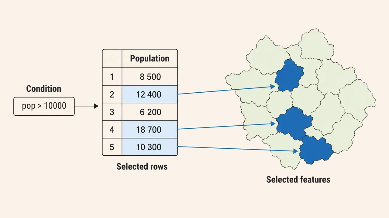
Table joins
External tables join to spatial layers using a shared primary key. For example, if a district boundary layer and a statistical spreadsheet share district_id, socioeconomic metrics join directly to boundaries. Key formatting and data types must match across sources.
If keys duplicate in the join table, standard joins cause unexpected record inflation or dropped rows. Analysts verify key uniqueness, whitespace trimming, and null frequencies beforehand. For one-to-many relationships, relational connects (relate) or pre-aggregation replace simple joins.
Quality control
Attribute quality is judged by completeness, accuracy, consistency, and currency. Mandatory fields must not carry blanks, codes should reference authoritative domain dictionaries, and values must fall within valid physical ranges. Negative building floors or future construction dates require immediate correction.
In production, schemas are formalized in advance, lookup domains enforced, and validation rules enabled. Post-editing audits review duplicate IDs, unexpected nulls, outlier ranges, and category distributions. Cartographic inspection alone is insufficient: tabular audits are essential.
Conclusion
Attribute data encapsulates the semantic information of geographic features, providing the foundation for filtering, classification, calculation, and table joins in GIS. Reliable layers depend on preserving feature-row links, choosing suitable field types, distinguishing NULL from zero, and validating join keys. A rigorous schema transforms attribute tables into reusable, professional geospatial assets.