Web Mercator and web map projections
Introduction
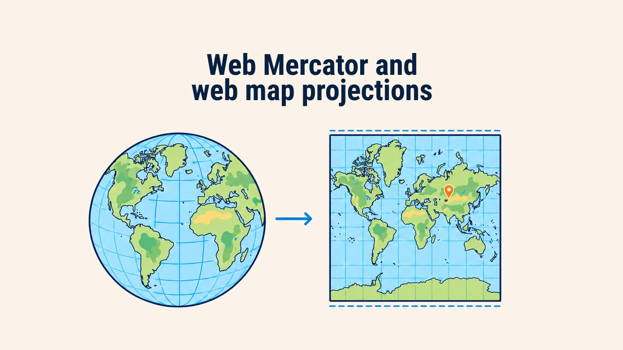
Web Mercator (or Pseudo-Mercator) is the planar map projection that converts Earth into a square coordinate grid, serving as the standard for online maps. Its official code is EPSG:3857. Base tiles across OpenStreetMap and Google Maps rely on this system.
Web GIS developers need to understand both the benefits and limitations of this projection. While convenient on screens, it severely distorts areas and distances; using it for spatial measurements leads to gross calculation errors.
Why Web Mercator
The Mercator projection is conformal: it preserves local angles and shapes. Street intersections cross at right angles, and buildings maintain their true proportions—essential traits for city navigation.
A second advantage is tile mechanics. Web Mercator projects the world into a square, making it easy to divide into equal square tiles at each zoom level. To simplify formulas, Earth is modeled as a sphere rather than an ellipsoid; hence the term "pseudo-Mercator." As a result, Web Mercator is not strictly conformal mathematically, though minor shape distortions remain imperceptible on screens.
The projection spread widely in the mid-2000s under the unofficial code 900913 before being standardized as EPSG:3857. Today, Leaflet, OpenLayers, and MapLibre use it by default.
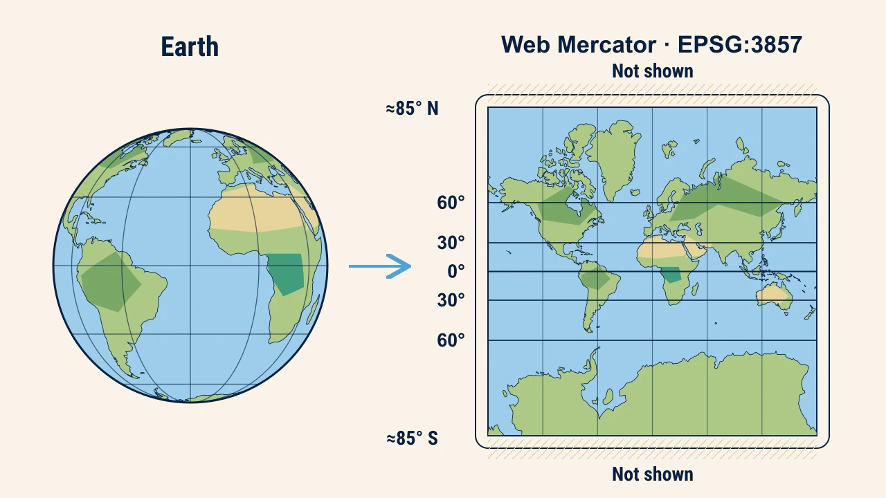
To maintain a square shape, maps are clipped near 85.05° North and South latitude; polar regions cannot be shown. The EPSG registry details transformation formulas and valid bounds.
Area and distance distortion
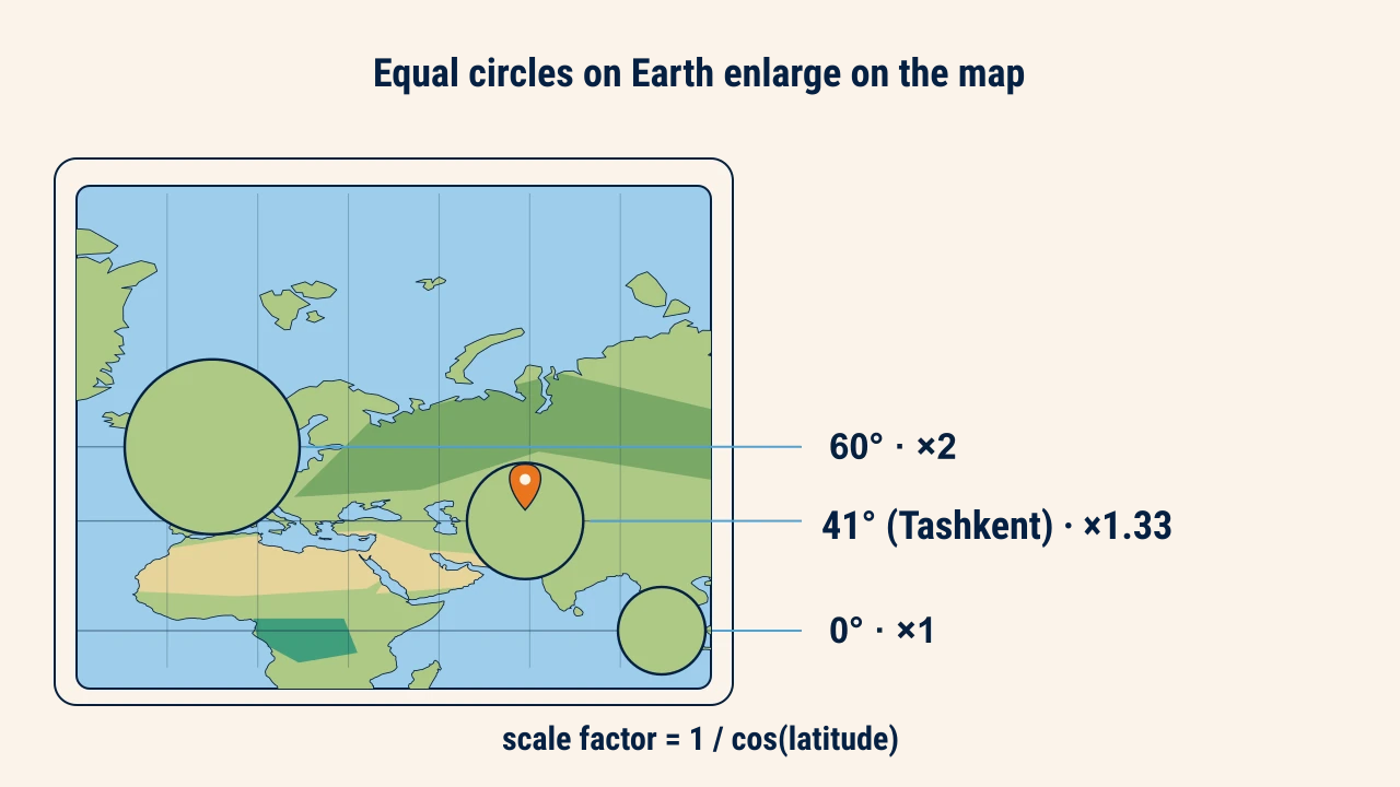
In Mercator, scale increases with latitude: the scale factor equals 1 / cos(latitude). It is 1.0 at the equator, roughly 1.33 at Tashkent's latitude (41.3° N), and 2.0 at 60° N. Measured distances in Tashkent appear roughly one-third longer than ground truth.
Area distortion grows quadratically. At Tashkent's latitude, polygon areas expand by about 1.77 times; at 60° N, by 4 times. This is why Greenland appears comparable to Africa on web maps, even though Africa is 14 times larger.
Distortions also vary within a country. Uzbekistan extends from 37° to 45.5° N, with scale factors from 1.25 in the south to 1.40 in the north. On nationwide thematic maps, northern regions appear noticeably enlarged.
Difference between EPSG:4326 and EPSG:3857
EPSG:4326 is the WGS 84 geographic coordinate system, measuring coordinates in degrees of latitude and longitude. EPSG:3857 is a projected Cartesian system; its units are nominal meters, matching ground meters only at the equator.
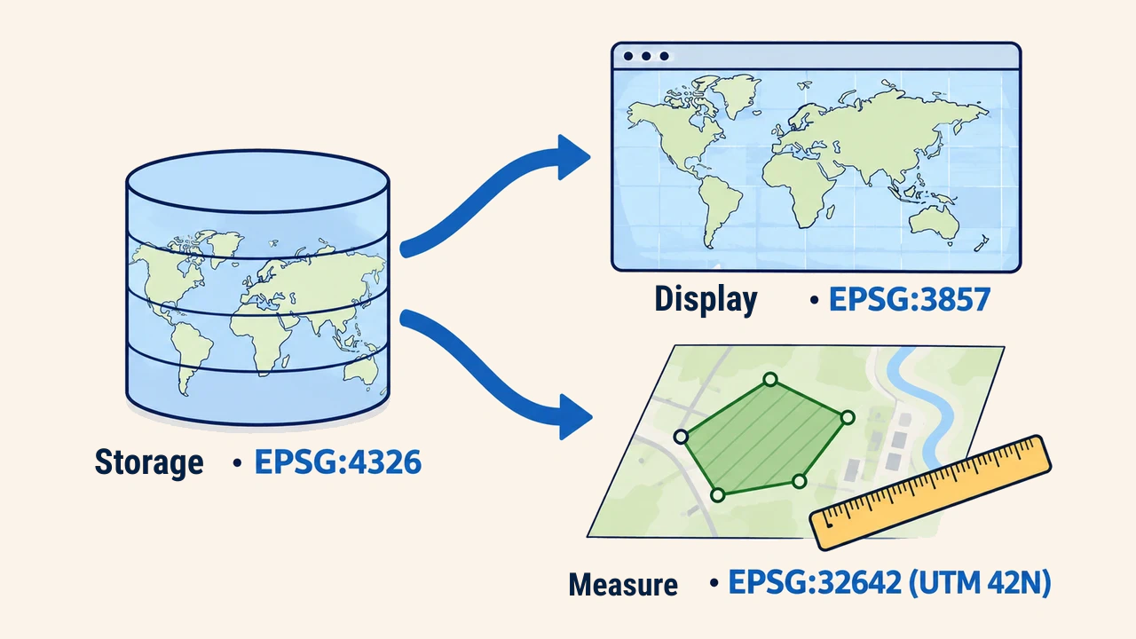
Each serves distinct purposes. Geospatial data is stored and exchanged in EPSG:4326; for instance, the GeoJSON specification (RFC 7946) mandates WGS 84 coordinates. Web mapping libraries consume this data and reproject it on the fly into EPSG:3857 for display. Fundamental CRS concepts are covered in coordinate systems and CRS in GIS.
Practical rule: storage, display, measurement
Web GIS architectures separate spatial workflows across three CRS roles:
- Storage and API transfer:
EPSG:4326; - Interactive map display:
EPSG:3857; - Area and distance calculation: an equal-area or local projected CRS (such as UTM zone 42N,
EPSG:32642, for Tashkent).
A common mistake is calculating parcel areas directly from EPSG:3857 coordinates. A 100-hectare parcel near Tashkent evaluates to roughly 177 hectares under this approach. Some mapping libraries provide geodesic tools that correct for latitude, but developers should verify library capabilities before relying on them.
Conclusion
Web Mercator became the web standard by preserving local shapes and tiling cleanly into square grids. The trade-offs include strong area distortion at high latitudes and clipped polar regions.
Web Mercator is used for screen display, data is stored in geographic coordinates, and quantitative measurements are run in suitable projected systems. Separating these roles prevents misleading spatial results.